B′
East
CR94-61
CR94-73
CR93-27,11
slough
slough
78-540 m
78-450 m
78-255 m 78-150 m
86-9 m
86-180 m
Thawed?
thawed?
1
85-50 m Borehole with
transect number
and distance
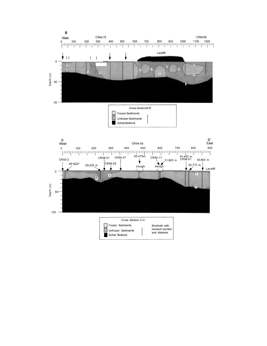
c. BB'. Includes data from GPR transects 94-78 and 94-86.
85-50 m
d. CC'. Located west of the landfill and includes transect CR94-50 data.
Figure 20 (cont'd).
permafrost can control ground water movement,
into the bedrock are critical links between aqui-
recharge, and discharge between different aqui-
fers. Suprapermafrost aquifers generally exist in
fers (e.g., Fig. 20d, e, f). Flow can even become
abandoned channels and, in some cases, beneath
channeled between frozen materials (e.g., Fig. 20c).
roads and other disturbed areas, such as the area
around the landfill (Fig. 16). Deeply frozen areas
Ground water aquifers
restrict ground water movement and may isolate
Unfrozen sediments around and inside the per-
aquifers, while complicating flow patterns (Fig.
mafrost are potential locations of aquifers. In the
17).
north-central cantonment area, zones that are un-
Deeply frozen materials are extensive along the
frozen at the surface and extend uninterrupted
base of Birch Hill, where bedrock is relatively shal-
19


 Previous Page
