2 m) active layer, particularly south of Birch Hill
Although we have limited data on ground
and east of Ski Hill Road. Unfrozen materials
water conditions north of the Chena River, the
below the permafrost increase in thickness to the
numerous physical constraints on aquifers and
south as the depth to bedrock increases and per-
ground water movement limit the potential
mafrost thins. The subpermafrost aquifer increases
avenues of flow. Two "external" sources of ground
in volume to the south as well and is more con-
water may determine the direction and velocity
nected with the regional Tanana Valley aquifer.
of flow in this area. An aquifer in Birch Hill, which
Birch Hill
Ski Area
Based Upon Limited Data
> 1.03.0 m Thaw
Thawed
Above Permafrost
Permafrost Absent
Speculative; Data Lacking
≤ 1.0 m Thaw Annually
> 3.0 m Thaw
Above Permafrost
Active Landfill Area
Above Permafrost
Birch Hill Aquifer Dominance
Tanana-Chena Alluvium Aquifer
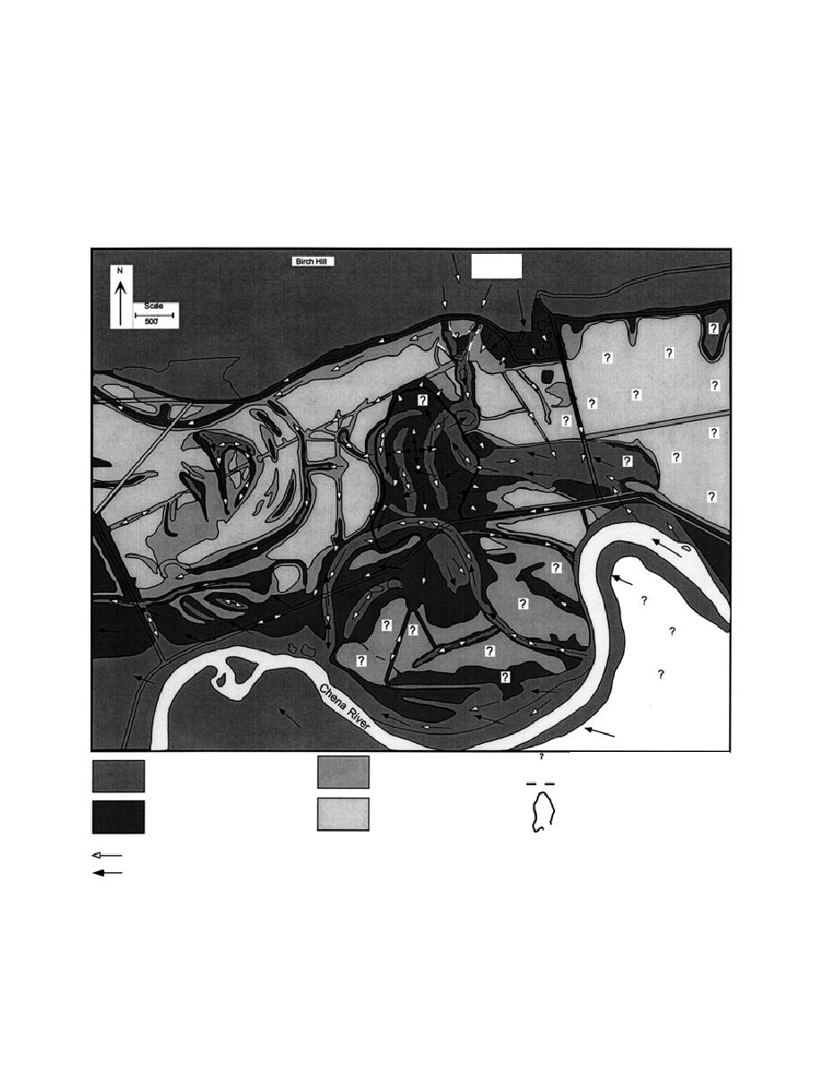
Figure 22. Near-surface and suprapermafrost flow paths. Depicted are ground water flow patterns possible if they are
controlled by an aquifer in Birch Hill or if they result from the dominance of the subregional aquifer in the Tanana-Chena
alluvium. Ground water flow is restricted to deeply thawed or unfrozen materials above bedrock; permafrost distribution
and dimension are critical controls in this regard. Near-surface flow could result in off-site migration of contaminants in
extremely divergent directions.
24


 Previous Page
