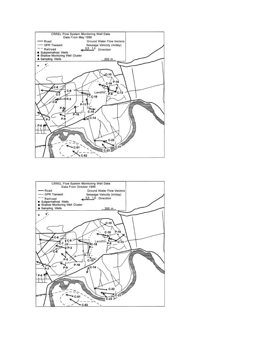
Flow directions at 30 m below
the surface are generally consistent
from well to well, except where
permafrost is in contact with bed-
rock over a large area (Fig. 21). In
that situation, flow is diverted
around deep permafrost and may
vary by over 90 from the usual
west to northwest trend. This is ex-
emplified by a northeasterly flow
of water west of a deep (more than
85 m) permafrost "plug" that is
southeast of the landfill along the
Chena River (Fig. 17 and 21).
A strong seasonal change in
direction from the prevailing west
northwest flow pattern is evident
north of River Road (Fig. 21).
Lower velocities and higher water
levels during the late spring and
summer are associated with a
more northerly flow, but shifts in
flow direction to the west during
fall to winter correlate with a lower
c. May 1996.
water table. The direction probably
changes in response to the large
flux of water from the Tanana
River during summer (e.g., Ceder-
strom 1963, Williams 1970). Late
in the year, the flux of water from
the Tanana River into the alluvial
aquifer declines and local factors
may be controlling flow.
HYDROGEOLOGICAL
CONCEPTS
Ground water in the north-
central cantonment flows in pat-
terns that reflect the impermeable
confining conditions imposed by
permafrost, the topography, and
the relief of the buried bedrock
surface. For example, flow direc-
tions vary from the prevailing west
to northwest regional trend where
permafrost extends into bedrock
along the base of Birch Hill and in
the area southeast of the landfill.
Former channels and sloughs are
unfrozen, and narrow trails, roads,
and other disturbed locations are
d. October 1996.
deeply thawed above permafrost,
Figure 21 (cont'd).
as are places with a thin (less than
23


 Previous Page
