Permafrost Generally Extends
Permafrost Absent
Through Sediments into Bedrock
Sediments Unfrozen to
Based Upon Limited Data
at an Unspecified Depth
Bedrock; Water Bearing;
Bedrock Presumed Unfrozen
Water Not Encountered During
Drilling Through Weathered Bedrock
Speculative; Data Lacking
Surface; Locally Sporadic and
Discontinuous Thaw Zones may
Permafrost Present to
be Present at the SedimentBedrock
Unspecified Depth
Interface, Especially Near Unfrozen
Areas and Adjacent to the
Active Landfill Area
Sediments Thawed Between
Subpermafrost Aquifer
Permafrost and Bedrock;
Subpermafrost Aquifer Present
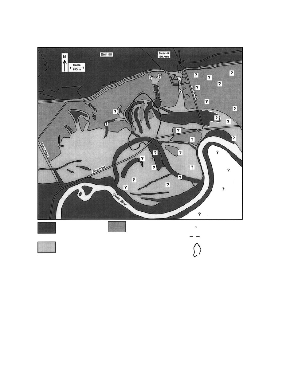
Figure 17. Locations of areas frozen into bedrock, areas where permafrost is underlain by unfrozen sediments
that overlie unfrozen bedrock, and unfrozen zones that penetrate the permafrost completely. Unfrozen zones
generally are within former sloughs or channels, and permit communication between supra- and subpermafrost
aquifers. The large areas of materials that are frozen into bedrock constrain ground water interactions among
aquifers in Birch Hill and the Tanana Valley alluvium; they also modify flow patterns by their impermeability. A
bedrock aquifer in Birch Hill may communicate through fractures, such as the thaw zone associated with Finnegan's
Pond (upper right of landfill). Subpermafrost aquifers communicate with the large unfrozen area of alluvium
beneath and south of the Chena River. Data are practically nonexistent, however, on permafrost and bedrock
depths east of Ski Hill Road, an area critical to understanding ground water conditions north of the Chena River.
The mapping of unfrozen zones and aquifers beneath the landfill is based on our interpretations of subsurface
conditions surrounding it, which were obtained from historical aerial photographs.
16


 Previous Page
