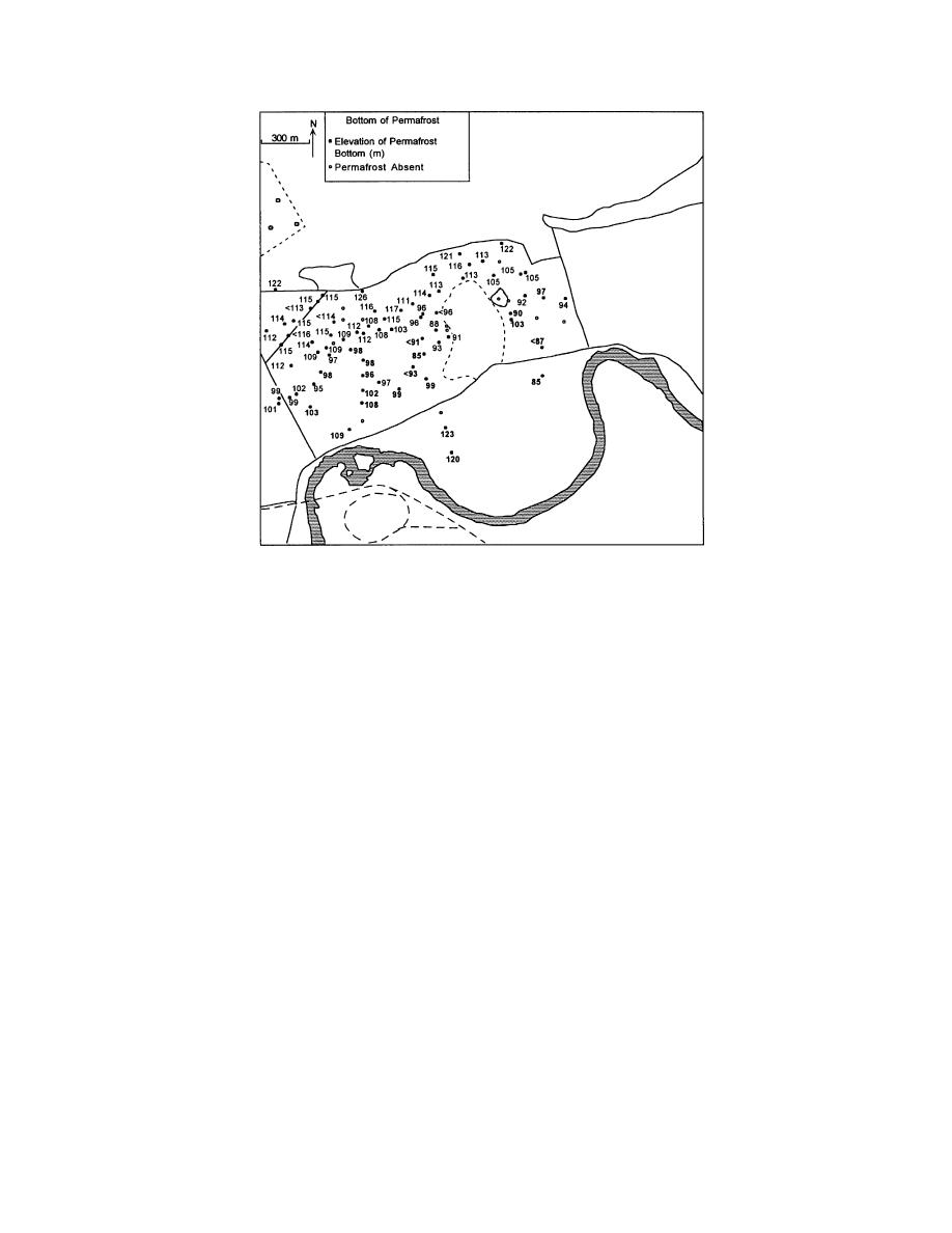
b. Elevations of bottom of permafrost in unconsolidated sediments as re-
corded in borehole logs.
Figure 15 (cont'd). Elevation of permafrost (U.S. Army Engineer Dis-
trict, Alaska, unpublished borehole logs). Bold numbers show wells
drilled between 1 March 1994 and 30 June 1995. All others were drilled
between 1 July and 1 December 1995.
data point to a thaw zone adjacent to the landfill
frost. Two maps were needed--one showing
that is 20 to 50 m wide, thickening rapidly close
depths to the top of permafrost (Fig. 16) and a
to its boundary. Aquifers are present in this
second showing conditions at depth (Fig. 17).
thawed zone.
The first map shows areas with a shallow thaw
The base of the permafrost lies at depths
layer (1 to 3 m), deeper near-surface thaw (less
ranging from as little as 10 to over 40 m, with
than 3 m), and a thin, seasonally frozen active
depths shallowing adjacent to unfrozen areas,
layer (less than 1 m). The latter shows where per-
including the Chena River on the south (Fig.
mafrost extends to or into bedrock, or where there
15b). Permanently frozen sediments are gener-
are unfrozen sediments between the bedrock and
ally thinner in the northern third of the mapped
the permafrost. In both, sediments that are unfro-
area, but only because bedrock is present at a
zen continuously from the surface into bedrock
shallower (less than 25 m) depth. The thickest
are also located. Conditions beneath the landfill
permanently frozen sediments (more than 80 m)
are interpreted from subsurface conditions adja-
are southeast of the landfill (Fig. 15b). In some
cent to it.
cases, the depth to the base of permafrost is
unknown because our boreholes could not pen-
Bedrock depth and permafrost relationships
etrate more than a few meters into frozen bed-
Overall, the depth to bedrock is about 7 m near
rock.
the base of Birch Hill, but deepens to over 85 m
We have combined the various data sources to
just south of River Road (Fig. 18). The depth to
map the three-dimensional distribution of perma-
bedrock and the slope of its buried surface
14


 Previous Page
