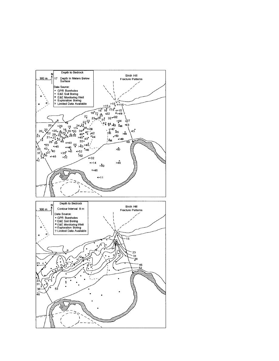
formerly cut deep into the bedrock surface (Fig.
Interpretive cross sections (Fig. 20) show the
19). Above the valley surfaces, unconsolidated
high variability of the subsurface distribution of
sediments that fill these bedrock valleys are thicker
permafrost, as well as the irregularity of unfrozen
than in the surrounding area and are likely a focal
zones in and above the permafrost in relation to
zone for ground water flow where the sediment
the bedrock surface. The abrupt and sometimes
is unfrozen (e.g., Lawson et al. 1996).
deep interfaces between unfrozen sediments and
Figure 18. Depth to bedrock from bore-
holes drilled north of the Chena River.
Maximum depth of drilling to bedrock was
limited to 1 to 2 m or less. Values with
"greater than" symbols are the depth pen-
etrated by drilling without encountering
bedrock.
Figure 19. Buried bedrock surface topog-
raphy based upon borehole data. The deep,
trench-like valley just east and northeast
of the landfill appears related to gullies in
the ski slope on Birch Hill. These features
may be associated with a fracture zone
within the bedrock. Preferential flow of
ground water below the permafrost within
materials filling this buried valley may be
an important factor locally controlling
subpermafrost ground water movement.
A smaller buried gully cut into the bed-
rock surface on the western edge may also
be important in this regard.
17


 Previous Page
