84-50 m
150-100 m AP 5595
84-170 m
Landfill
11-1480 m
85-50 m
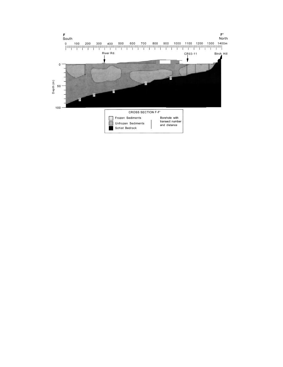
g. Northsouth cross section FF'through the center of the landfill.
Figure 20 (cont'd).
permafrost that are significantly different from
concluded that such unfrozen zones are devel-
subpermafrost flow patterns.
oped and maintained by artesian flow. In this case,
The thermal disturbance created by the landfill
an unfrozen fracture zone in the bedrock of Birch
over the last 40 or more years has increased the
Hill may be the artesian source. Cederstrom (1963)
reported previously that individual fractures and
depth to the top of permafrost. The deep thaw
fracture zones are the source of water in many, if
beneath the landfill is hydrologically important
not most, wells drilled into the schistose bedrock
because it could support a near-surface supra-
in the Fairbanks region.
permafrost aquifer. We speculate that any zones
Similarly, a buried bedrock valley that trends
of thin permafrost that existed 40 years ago may
mainly northnortheast to southsouthwest
now be completely thawed, while any thicker per-
extends beneath the frozen sediments at the base
mafrost may now have a deep layer of thawed
of the ski slope on Birch Hill (Fig. 15 and 19). It
sediments above it.
appears to be a continuation of a prominent gully
The landfill is also situated on top of at least
on the hillside and probably is a subsurface
one, and possibly three, northsouth linear zones
expression of a bedrock fracture zone. Data are
of unfrozen channel deposits (Fig. 4). Drilling
insufficient to determine, however, if indeed
revealed that unfrozen sediments extend to bed-
water is flowing within this valley off of Birch Hill.
rock (about 43 m depth) in one of these north
Near-surface aquifers in unfrozen zones that
south zones where it exits from beneath the west
are laterally confined by permafrost commonly
side of the landfill (Fig. 19).
have flow parallel to the impermeable permafrost
We suspect that the suprapermafrost aquifer
boundaries. Flow in the subpermafrost aquifers
is connected to the subpermafrost aquifer via the
may cause deviations from this trend until, at
unfrozen channel deposits (Fig. 17 and 20).
depth, the near-surface flow parallels that of the
Leachate from the landfill is likely to migrate
lower aquifer. The subpermafrost aquifer can also
towards such deeply thawed zones where it could
recharge or discharge through these unfrozen
be transported into the subpermafrost aquifer.
materials. In general, the subpermafrost aquifer
Whether leachate actually migrates through the
is artesian, with flow approximately following the
fill materials is unknown, however.
regional trend (e.g., Lawson et al. 1996), whereas
the local hydraulic gradient, alluvial stratigraphy,
Site-specific seepage data
Site-specific ground water data show both sea-
and permafrost configuration can create flow
patterns in near-surface sediments confined by
sonal and annual variability in water levels, flow
21


 Previous Page
