permafrost extends into the bedrock. The bedrock
not always the strongest events at depth (e.g.,
shallows at the northern end of the transect near
between 400 and 500 m), and south of 300 m, there
Birch Hill, ranging from about 1012 m deep at
are no returns from bedrock because of the unfro-
925 m distance and gradually deepening to about
zen, saturated sediments that are between the
21 m at 750 m distance. The bedrock depth then
base of permafrost and bedrock.
appears to hold steady to about 500 m distance,
Transect 94-70 (Fig. 13) runs west to east, begin-
where it deepens sharply to about 44 m at about
ning near Canol Road. It has a well-defined sub-
450 m distance. Of note, bedrock returns are
horizontal reflector from subpermafrost water
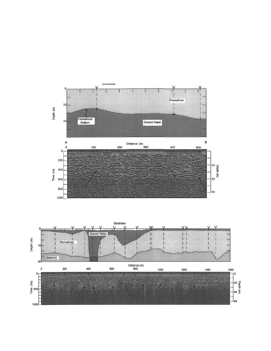
Figure 13. 50-MHz profile of transect 94-70, which trends west from near Canol Road and
ends east of the landfill site (Fig. 6). Ground water is interpreted to occur beneath the entire
transect.
Figure 14. 50-MHz profile and interpretation of transect 93-11, which trends south-southwest to north-northeast
approximately parallel to the base of Birch Hill (Fig. 6). Arrows in radar traces indicate bedrock reflectors.
12


 Previous Page
