that is in contact with the base of the permafrost.
present at some locales in the center of the pro-
Permafrost thickness is relatively constant, vary-
file, but it is apparently absent elsewhere.
ing from about 2835 m along the transect. There
is no consistent reflection from bedrock beneath
Permafrost distribution
permafrost. Bedrock was also not encountered in
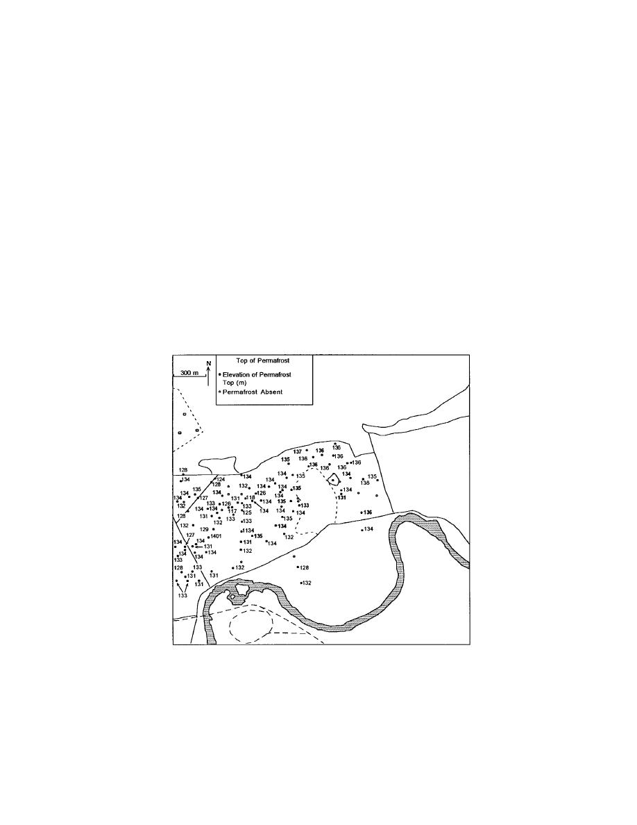
Our data show that the extent and thickness of
any of the boreholes and apparently lies below
permafrost vary greatly across the north-central
50 m depth. Reflectors in the permafrost are
cantonment area (Fig. 15). Seasonal freezing
from features that may include strata of differ-
depths often exceed 3.0 m, while active layers may
ing grain size, sedimentary structure, or higher
have seasonal thaw depths as little as 0.3 m. The
ice volume.
depth of thaw apparently varies with drainage,
vegetative cover, organic content of the sediments,
Transect 93-11 is 1600 m long, trends west to
and other factors (e.g., Hopkins et al. 1955, Pw
east, and passes just north of the landfill (see
1958, Ferrians and Hobson 1973). Deeply thawed
Fig. 6). Bedrock is a prominent reflector at depths
materials, ranging from several meters to over 20
of 20 to 30 m along nearly its entire length (Fig.
m in depth, commonly exist beneath disturbed
14). Only where signals are attenuated by water,
areas, such as roads, and in former swales and
such as locations with standing water or where
deeply thawed sediments are near the surface, is
channels (Fig. 15a). Deep thaw may also be
expected beneath the landfill; borehole and GPR
this reflector absent. A subpermafrost aquifer is
a. Elevations of the top of permafrost from borehole records. Active layer
thickness (more than 2 m deep) was also measured in August and Sep-
tember 1994 using a hand-driven steel probe.
Figure 15. Elevation of permafrost (U.S. Army Engineer District,
Alaska, unpublished borehole logs). Bold numbers show wells drilled
between 1 March 1994 and 30 June 1995. All others were drilled be-
tween 1 July and 1 December 1995.
13


 Previous Page
