dent shipping agents. The directory lists altogether
then the small river craft are at risk in crossing
only 28 Russian ports, and only one, Igarka, is
open coastal water with uncertain weather.
located on the NSR. Four of the ports are found on
the White Sea (Archangel'sk, Kandalaksha, Mezen,
Northern seaports
and Onega) and two on the Barents Sea (Murmansk
and Nar'yan Mar). As of July 1994, Igarka was the
Sources consulted
only port on the route that was officially open for
This section summarizes information for
foreign stopover. Information on northern Russian
Russia's northern ports that are currently open for
seaports from Ports of the World is included as Ap-
foreign stopover or are scheduled to be opened at
pendix F.
some future unspecified date. Several providers
Another directory of ports worldwide that is
of port information were consulted, primarily
published periodically is the World Port Index
Lloyd's of London in England (LLP), the U.S. De-
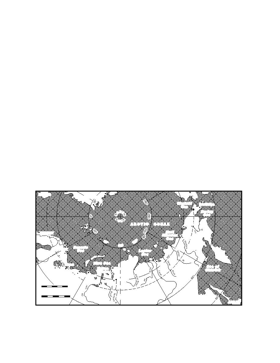
(DMA 1992a). It lists a total of 45 north coast and
fense Mapping Agency (DMA), and the Russian
far eastern Russian ports (App. G). Twenty-four of
State Ministry of Transport (RSMOT).
these are located between the NorwegianRussian
In addition, a computerized database entitled
border and the Kara Strait, and eleven more lie
Commercial Sea Ports of the CIS and Baltic States, and
along the NSR (Fig. 28). Its wide array of informa-
River Ports of Russia, available from Russia's Cen-
tion is presented in a table nearly 75 columns wide.
tral Marine Research and Design Institute
The Defense Mapping Agency also publishes a
(CNIIMF), is described in Appendix E. The
series of sailing directions that provide detailed
CNIIMF database is currently available only in
navigational information for harbors, coastlines,
Russian and was not consulted for this study.
Ports of the World 1994 (LLP 1994) is a compre-
and passages of the entire world. These are peri-
hensive directory that provides a wide range of
odically updated in regional volumes every 5 to
navigational information on approximately 2,700
10 years with subsequent amendments between
ports worldwide. It is updated annually, and its
editions appearing in the DMA Weekly Notice to
information includes each port's authority, physi-
Mariners. Sailing Directions (Enroute): Northern Coast
cal description, navigation season, the type of cargo
of Russia (DMA 1993) covers the region from the
handled, facilities and accommodations, approach
NorwegianRussian border to the Bering Strait and
was consulted for some of the information pre-
description, communication frequencies, and resi-
Alaska
ICELAND
GREENLAND
C hS k c h i
u
Provideniya
ea
Bering
S
ORT
ea
OL
Pevek
ARCTIC
OCEAN
S East
a d yr
NORWAY
iberian
S
Ambarchik
ea
0
60
SWEDEN
12
90
B aS e n t s
r
Murmansk
nd
e
Riv
ea
Laptev
S
ea
FINLAND
Kandalaksha
ver
Kara Sea
Tiksi
Mezen
Onega
O ea of
S
r
V apitana
K
Dikson
khotsk
Arkhangel'sk
arzugina
r
Golchikha
Khabarovo
Nar'yan-Mar
River
Dudinka
Ust-Port
Novvy Port
en
Ol
0
500
LE
Igarka
RC
CI
Nautical Miles
R
IC
ARCT
0
1000
R
U
S
S
I
A
Kilometers
JAPAN
Figure 28. Russian Arctic seaports listed in DMA (1992a). Those in bold type and marked with triangular
symbols are open for foreign stopover, as of July 1994.
44


 Previous Page
