In summary, the contaminated ar-
eas of sumps 1, 2 and the sump below
the utilidor vent seem well isolated
from the water well. The radar indi-
cates about an 8-m radius for the wa-
ter well and a spread of about 15 m for
the sump 2 contamination toward the
well. This leaves more than 45 m sepa-
ration between the well and the near-
est contamination. Since the well bulb
is below the contamination, the radar
suggests that there is about 55 m sepa-
ration between the nearest contamina-
tion and the water well itself. Howev-
er, since probes indicate that the radii
of the sewage sumps are about 21 m,
not 15 m, it is likely that the actual sep-
aration is closer to 50 m.
Far sump
This survey was done to verify the
location of an old sewage sump and to
estimate its lateral extent. The expect-
ed location from station drawings is at
point N and is labeled far sump in Fig-
ure 5, where three parallel survey lines
are located. The lines were 100 m long
and spaced 15 m apart. In January
1991, using hot point drills provided
by CRREL, M&E personnel deter-
mined that the depth to contamination
was approximately 12 m. The lateral
radius of this contaminated zone was
estimated to be about 21 m. This sump
has not been in use for many years and
has refrozen.
We used the 400-MHz transducer
unit at a time range of 200 ns to show
approximately 20 m of signal penetra-
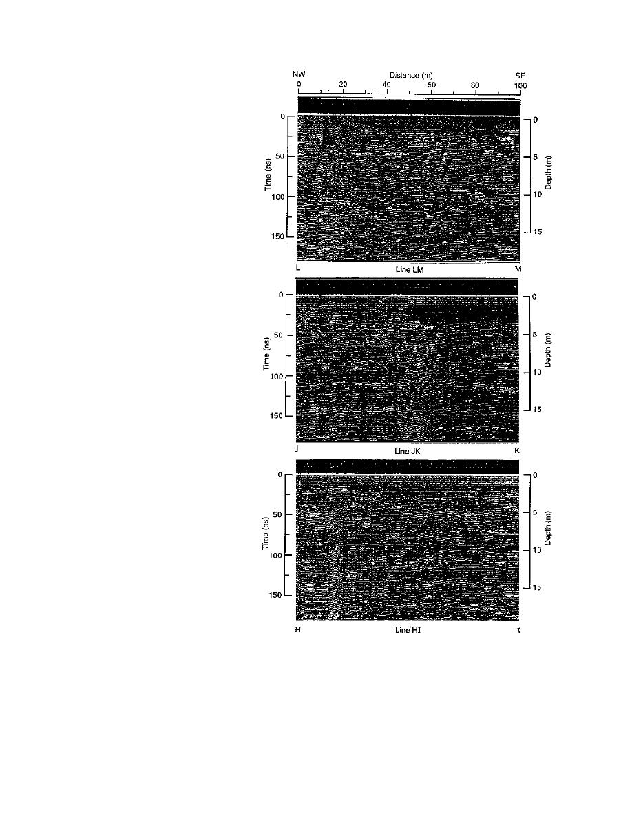
tion into the firn. The three 100-m long
parallel time section profiles (lines HI,
JK and LM) are shown in Figure 15.
The profiles are 15 m apart. Only the
center line, JK, shows diffractions in
the area of the sewage sump at 50 to 55
m distance. An early hyperbola at 2.4
Figure 15. Three parallel 400-MHz profiles recorded at 200 ns at the
m depth is from air waves reflecting
far sump location (lines HI, JK, LM in Figure 5). Only line JK picked
off a surface object because its slope
up diffractions at depth.
gives a refractive index less than 1.1. A
series of hyperbolas originate at a
those seen around sump 2 in Figure 13 and is fur-
depth of about 6.5 m and extend vertically down
ther evidence for firn subsidence around the
through the record. Their slopes give a refractive
sumps. None of the diffractions originating near
index of 1.39 (ε = 1.93). The dip in the layering
12 m depth are of unusual intensity, but at the 16-
horizons on either side of the sump are similar to
to 17-m depth, the diffractions become more in-
16


 Previous Page
