Leydecker
Mill Road
Road
Winspear
ICS Site
Subdivision
Kotecki
Grove
Upstream
Brady's
House
House
Transit
Road
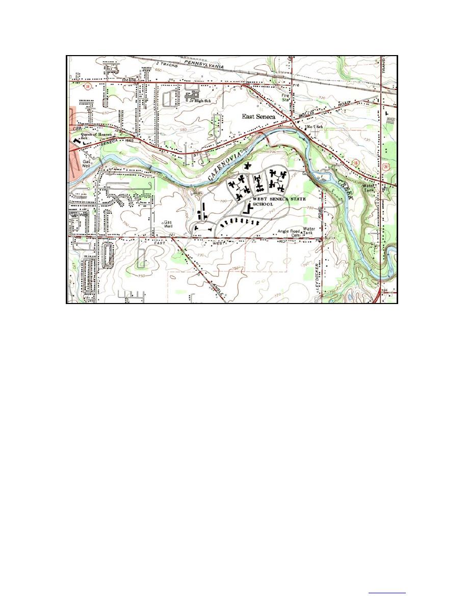
Figure 15. Topographic map of reach of Cazenovia Creek valley modeled for upstream effects caused
by the cylindrical-pier ICS. (From USGS Orchard Park Quadrangle, 1965.)
volume upstream of the ICS. Nevertheless, we would
of shear walls) and on the small floodplains that line
expect the ICS to retain thick, strong ice well beyond
the valley floor. Once the ICS forms a jam, melting and
the 6000-cfs design discharge.
slow washouts will reduce its volume throughout the
The ICS jam will be grounded near the structure and
event. At high discharge, ice washouts will accelerate
free-floating beyond about 200 ft upstream. Beyond the
as floes break and release through the ICS gaps. We
grounded section, the ICS jam is hydraulically similar
require estimates of each term in this process to deter-
to a natural jam, adding a thick, rough, floating ice cover
mine Vj(Q).
to the river. The jam produces much higher water lev-
els along its length than would occur for the same dis-
River ice supply
Buffalo District personnel conducted ice-thickness
charge during open-water events. However, washouts
measurements in 1983 and aerial surveys in 1983 and
and melting of smaller floes will reduce the retained
ice volume (and hence reduce jam length) throughout
1985 to observe the ice-formation process and deter-
the event. Beyond about 800010,000 cfs, the washout
mine the ice supply in Cazenovia Creek (U.S. Army
rate should accelerate, depending on the ice thickness
1986b). They estimated that the pre-breakup ice sup-
and strength.
ply "from the headwaters to Cazenovia Street" was 7.8
106 ft3 in 1983 and 9.2 106 ft3 in 1985. Although
Ice jam volume
the ice-thickness data themselves are not available,
The volume of ice in the jam retained by the ICS
maps used for the surveys during 1983 record about
governs the extent of high water induced upstream. This
0.7-ft-thick solid ice. Consequently, the thickness of
ice volume will change during a breakup event, and we
solid ice in 1985 was probably about 0.9 ft. These vol-
require an estimate of the volume retained as a func-
ume estimates are consistent with ice covering 100%
tion of discharge, Vj(Q). The initial ice run from up-
of the 16 miles of river from Cazenovia Street to East
stream will leave ice floes along the banks (in the form
Aurora, assuming an average cover width of 120 ft.
13
TO CONTENTS


 Previous Page
