but others may be frozen to bedrock; the reasons
the area immediately east of the landfill, while
for this difference are unknown.
similar features trend northsouth to the south
The unconsolidated materials of the Chena
and west (Fig. 4 and 5). Similarly, the northsouth
River floodplain lie unconformably above dark
trending meander scrolls are crossed by eastwest
pelitic schists of the Yukon-Tanana Complex, for-
trending ridges and swales further to the south,
merly identified as the Birch Creek Schist (King
meaning that the latter features were deposited
1969, Pw et al. 1976). This metamorphic unit is
more recently.
generally of lower greenschist facies, and is
The relative age of the alluvial sediments can
thought to be of Precambrian age (Pw et al.
be an important factor hydrologically by dictat-
1976). Birch Hill, which rises approximately 200
ing the three-dimensional relationship of layers
m above the adjacent alluvial plain, is also com-
that either do or don't conduct water (i.e., coarse
posed of this highly fractured and foliated schist.
gravel channel vs. fine-grained overbank depos-
In most areas of Birch Hill, the bedrock is overlain
its). The Chena River basin also received glacial
by eolian silt with thicknesses that may exceed 3
runoff during the last major period of glaciation
m or more.
(Hamilton 1994), which implies that channel
deposits of this age may be significantly coarser
than material being transported by the Chena
METHODS OF INVESTIGATION
River today. Similarly, overbank deposits from this
Our investigations have been multifaceted. We
time may be thicker and contain more silt than
used standard ground-penetrating radar (GPR)
recent deposits.
techniques, as well as new methods and equip-
Former channels and swales tend to be slightly
lower than the surrounding terrain, causing
ment that we developed for this study, to define
water to collect during wet times of the year. These
the extent and depth of permafrost and of satu-
topographic features generally retain their natu-
rated aquifer sediments (Arcone et al., in press).
ral morphologies and are often the sites of slow
These data were combined with other data from
moving streams, unless they are artificially exca-
drilling records, ground water flow sensors, aerial
photographs, and surface observations to find out
vated to improve drainage. There are unfrozen
how aquifers were distributed. From these analy-
sediments beneath some of these alluvial features,
ses, we have developed several
hydrogeological concepts of the
north-central cantonment area.
Ground-penetrating
radar
Ground-penetrating radar (GPR)
analyses produced the data neces-
sary to outline the three-dimensional
permafrost and ground water stratig-
raphy of the area. Multiple GPR pro-
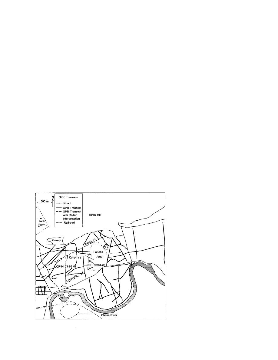
files were therefore acquired along
numerous transects established on
new and existing trails across the
area (Fig. 6). Prior to profiling, the
trails were cleared of vegetation by
hydroax. Their locations were later
surveyed by professional crews.
GPR data were obtained between
1993 and 1995, with most acquired
in MarchApril 1994, August
September 1994, and MarchApril
1995. Our radars were Geophysical
Survey Systems, Inc., SIR Models
4800 and 10a+ control units and
Figure 6. GPR transects in the area north of the Chena River.
6


 Previous Page
