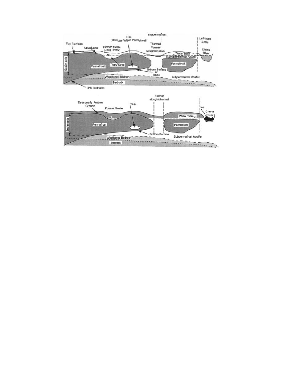
Figure 2. Idealized sketch illustrating the configuration and nomenclature for dis-
continuous permafrost and ground water aquifers associated with it; (top) summer
conditions, and (bottom) winter conditions.
Ferrians and Hobson 1973, Williams and Van
studies, part of the effort to remediate contami-
Everdingen 1973, Abele et al. 1984, Lawson 1986).
nant problems on the base, augments the results
Permafrost exists at various depths through-
of Lawson et al. (1996). In addition, an active land-
out the Fairbanks region, ranging from less than
fill (Ecology and Environment 1994) is one site in
0.5 to over 20 m to its upper surface. The base of
the north-central cantonment requiring hydro-
the permafrost commonly ranges from as little as
geological data for remediation.
10 to over 50 m below the ground surface (e.g.,
Ferrians 1965, Williams 1970). Permafrost thins
GENERAL BACKGROUND
rapidly to a few meters adjacent to thawed areas.
Thawed areas generally are deepest beneath geo-
Permafrost
logical features such as swales and former stream
The three-dimensional configuration and
channels, or beneath man-made disturbances such
extent of discontinuous permafrost controls
as roads, buried pipelines, buildings, excavations,
ground water flow to a large degree (Hopkins et
and areas cleared of vegetation (Lawson et al. 1994,
al. 1955, Williams 1970). Changes from frozen to
1996).
unfrozen conditions may be abrupt and without
The landfill (Fig. 3) was built on discontinuous
surface expression. The top and bottom surfaces,
permafrost in about 1950 and it probably has dis-
as well as lateral boundaries, of permanently
turbed the surface sufficiently for a thick thaw
frozen subsurface materials have highly irregular
bulb to develop beneath it (Ecology and Environ-
relief. Combined with the impermeability of
ment 1994). Sediments and bedrock on southerly
permafrost, these characteristics can significantly
exposed slopes such as Birch Hill (Fig. 1) are
affect ground water movement in the region (Fig.
generally unfrozen.
2). The distribution of frozen ground is a function
of not only the past and present environment, but
Ground and surface water
also of terrain characteristics, historical use, sur-
Two ground water flow systems are present in
face disturbances, vegetative cover, and conduc-
the cantonment area. The first is discontinuous,
tive heat transfer from the surface and ground
near the surface, and perched above the perma-
water (e.g., Hopkins et al. 1955, Mackay 1970,
2


 Previous Page
