in Figure 67. The main channel just off ERF can be
BATHYMETRIC MONITORING
identified on each of the five bathymetric pro-
AND WHITE PHOSPHORUS
files. This channel changes from a broad (~500
DEPOSITION
m), smooth profile about 14 m deep along the
Bathymetric monitoring of Knik Arm near the
northeastern corner of ERF to a more deeply in-
mouth of Eagle River provides us with important
cised (>16 m) and narrow channel (<200 m) near
information on the submarine and estuarine en-
the mouth of the Eagle River. The asymmetrical
vironment adjacent to ERF. Locations within this
profile has steeper slopes nearshore than those
area may be sites where sediment and WP is de-
further out into the Arm (Line D, Fig. 67). Line F
posited. Once identified, these areas should be
(Fig. 67), located near the northwestern corner of
sampled for analysis of WP.
ERF, shows that the channel is wider (near 1 km)
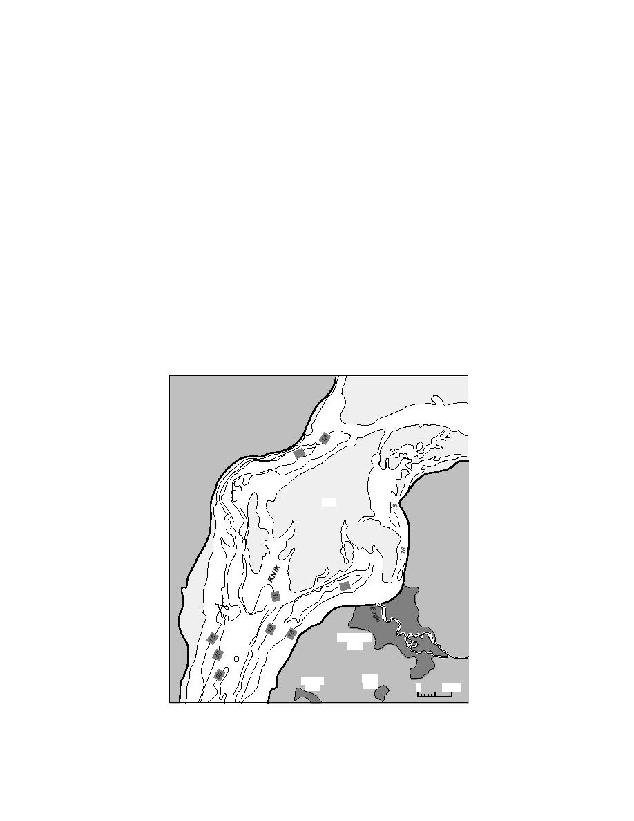
The Knik Arm near the mouth of the Eagle
and appears to merge with a secondary channel
River is 910 km wide (Fig. 65), having large tidal
at the intersection of Lines D and H. This second-
cycles (9 m) that cause the Arm to alternate be-
ary channel is located about 12 km offshore of
tween being tidally and fluvially dominated. At
ERF. It is characterized by sharp scarps, an un-
low tide, this portion of Knik Arm essentially
even or scabbed bed profile with 35 m of relief,
becomes a large anastomosing stream with a main
and shallower depth than the main channel. The
channel located directly off the coast of ERF.
main channel appears to handle most of the dis-
Highly turbulent flow with large standing waves
charge during ebb, and low tide in particular,
are common during low tide and as tidal flooding
when two large intertidal bars in the center of
starts.
Knik Arm are exposed (Fig. 65 and 67). The
scabbed profile of the secondary channel suggests
that localized and intense scour occurs in it.
Bathymetric profiles
Examples of the bathymetric transect lines (Fig.
The intertidal bar nearest ERF is located 0.2
20) from which Figure 66 is developed are shown
1.2 km offshore and is greater than 1.5 km wide.
M
AR
30
Goose
Bay
18
Mud
18
30
Eagle
Bay
18
R.
Eagle River
Flats
60
Otter
Sixmile
Lake
Lake
0
1 mile
Figure 65. Knik Arm in the vicinity of ERF.
53


 Previous Page
