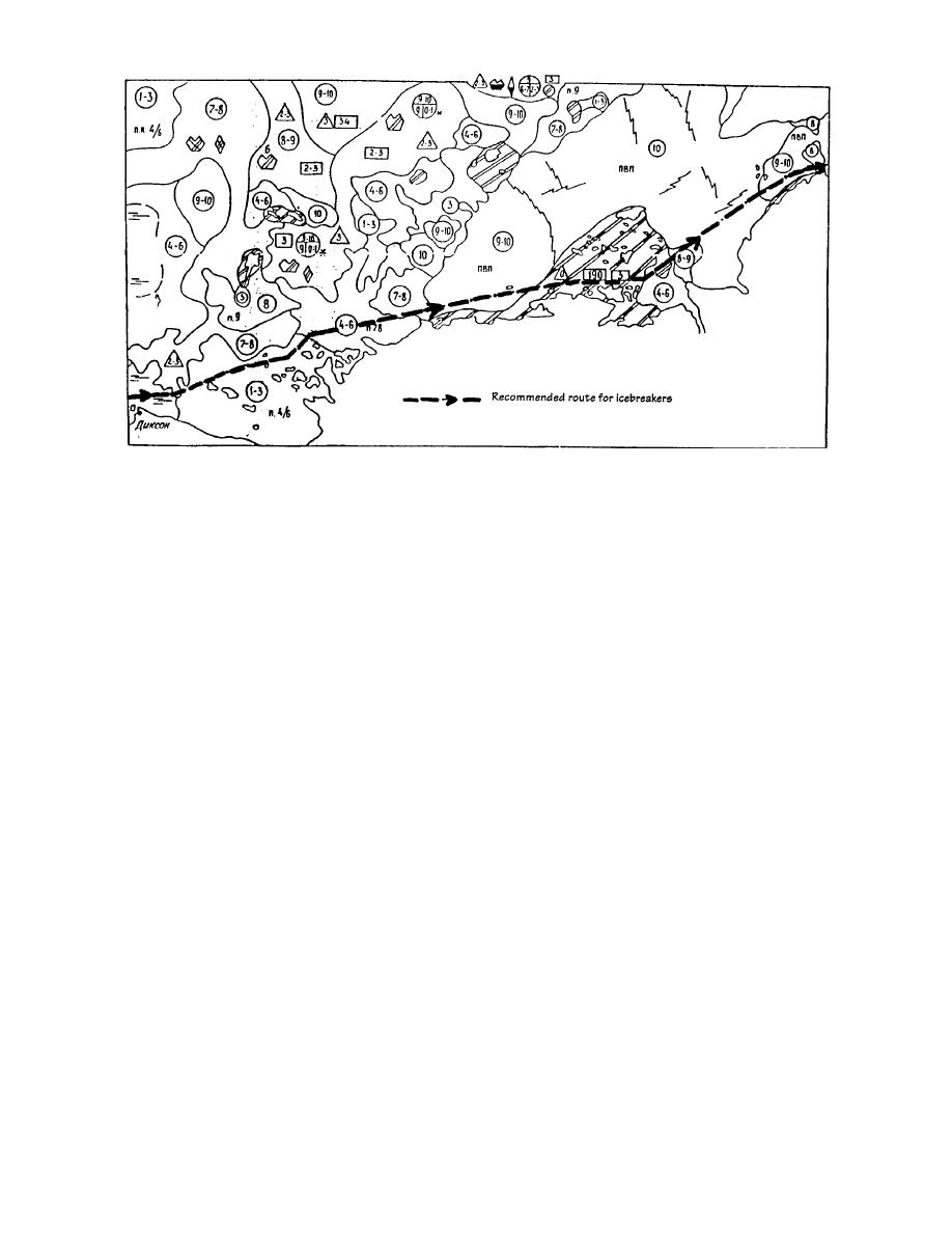
Figure 25. Russian ice chart and ship routing analysis for the coastal area between Dikson (lower left) and Cape
Chelyuskin (upper right). It represents the ice conditions on 1 and 2 September 1990, and was integrated from
satellite, aircraft, and icebreaker observations (from Buzuev 1991).
Ice mapping has been improved with the avail-
index map showing the coverage provided by the
ability of high-resolution imagery from the Euro-
1:100,000-scale and larger charts. Maps of the
pean Space Agency's Earth Resources Satellite
Yenisey River were 1:100,000, and several included
(ERS-1) platform. The Synthetic Aperture Radar
inset maps of shoal and port areas with scales rang-
(SAR) provides coverage with a resolution of 30 m
ing from 1:10,000 to 1:25,000. The complete list of
that is independent of darkness and cloud cover.
available hydrographic charts that were available
Nearly round-the-clock ice concentration mapping
as of November 1993 is included in this report as
with a resolution of 30 km is possible using data
Appendix D.
from the U.S. Defense Meteorological Satellite Pro-
gram (DMSP) Special Sensor Microwave/Imager
Forecasting and routing
(SSM/I). Although these technologies are not yet
Russian efforts to maintain up-to-date weather,
in widespread use by the Russians, who rely pri-
ice, and sea-state information along the Northern
marily on data in the visual and infrared spec-
Sea Route include the use of satellites, shipboard
trum, SAR and SSM/I services are commercially
helicopters, fixed-wing aircraft, shore-based and
available. Russian ice pilots can make expert use
drifting ice stations, drifting buoys, and shipboard
of the information if it is available aboard a for-
observations. The information is used in AARI mod-
eign ship under their escort. In 1991, routing for
els to produce both short- and long-range forecasts
L'Astrolabe's transit voyage was the joint work of
and ship-routing aids such as the ice map shown
the Nansen Environmental and Remote Sensing
in Figure 25. Ice maps and routing recommenda-
Center (NERSC), the ESA, the Norwegian Space
tions from the Dikson and Pevek MOHQs are sent
Center, and the Alaska SAR Facility. Ice maps made
twice a week to the icebreakers and then relayed
from the satellite products were telefaxed to the
to the ships under their escort. Radio communica-
ship using the Inmarsat satellite telecommunica-
tions along the route are handled from seven com-
tions system. The time delay from satellite obser-
munications centers located at Amderma, Dikson,
vation to shipboard reception of the maps ranged
Cape Chelyuskin, Tiksi, Pevek, Cape Shmidta, and
from 6 hours to 2 days. The quality and utility of
Provideniya. The Provideniya center is operated
the information was judged by the Russian ice
by the Ministry of Merchant Marine, and the oth-
pilots to be extremely good relative to their own
ers are maintained by the State Committee for
products. The routing work that was done for
Hydrometeorology (Ushakov et al. 1991).
38


 Previous Page
