der the Ministry of Transport. At the October 1992
NSR transit depends most critically on the ice con-
Northern Sea Route Expert Meeting, held in
ditions through this section; i.e., less consolidation
Troms, Norway, Mikhailichenko provided a dia-
and ice pressure, and the existence of leads, frac-
gram showing 23 charts that were available at that
tures, and polynyas.
time. We had extreme difficulty in obtaining them
from Russian government sources. In November
Navigation charts
1993, we contacted HydroCon, Ltd., a small, pri-
For this study, we investigated only U.S. and
vately owned distributor of geographic products
Russian sources for maps of the Northern Sea
based in St. Petersburg, Russia. They informed us
Route and, more specifically, hydrographic maps.
that the NSR nautical charts are actually issued by
Some maps of the Russian Arctic and Alaskan
the Russian State Navigation and Oceanography
coastlines are produced by the Defense Mapping
Department under the Ministry of Defense, which
Agency (DMA). The Alaskan coastline is fully cov-
had no policy for responding to one-time, small
ered, and there is fairly good coverage of the Rus-
orders for their products. HydroCon acted as a
sian coastlines in the Chukchi, East Siberian, and
facilitator in working through the official and un-
western portion of the Barents Sea. Except for three
official bureaucracy to obtain the charts and ar-
large-scale maps, one each for the Kara Gate and
range for their delivery. This exercise revealed the
the mouths of the Ob' and Yenisey Rivers, DMA
currently has no coverage between 45 and 135E
value of having an individual on-site in Russia to
facilitate requests and negotiations. Face-to-face
(the White Sea to the Novosibirskiy Islands). We
contact by one who speaks the language and knows
are not aware of any other publicly available maps
the social system seems to be much more effective
for this area from U.S. sources.
According to Mikhailichenko,* Russian hydro-
for producing the desired result than long-distance
graphic charts covering the entire route are being
inquiries. Most of the maps were in Russian, with
the exception of a few of the latest editions, which
declassified and made available for purchase from
were bilingual. Their dates of issue ranged from
the Russian State Hydrographic Department un-
1984 to 1993, with most showing revision dates
from 1990 to 1993. Their scales ranged between
1:10,000 and 1:2,000,000, with the majority scaled
* V. Mikhailichenko, 1993, Administration of the North-
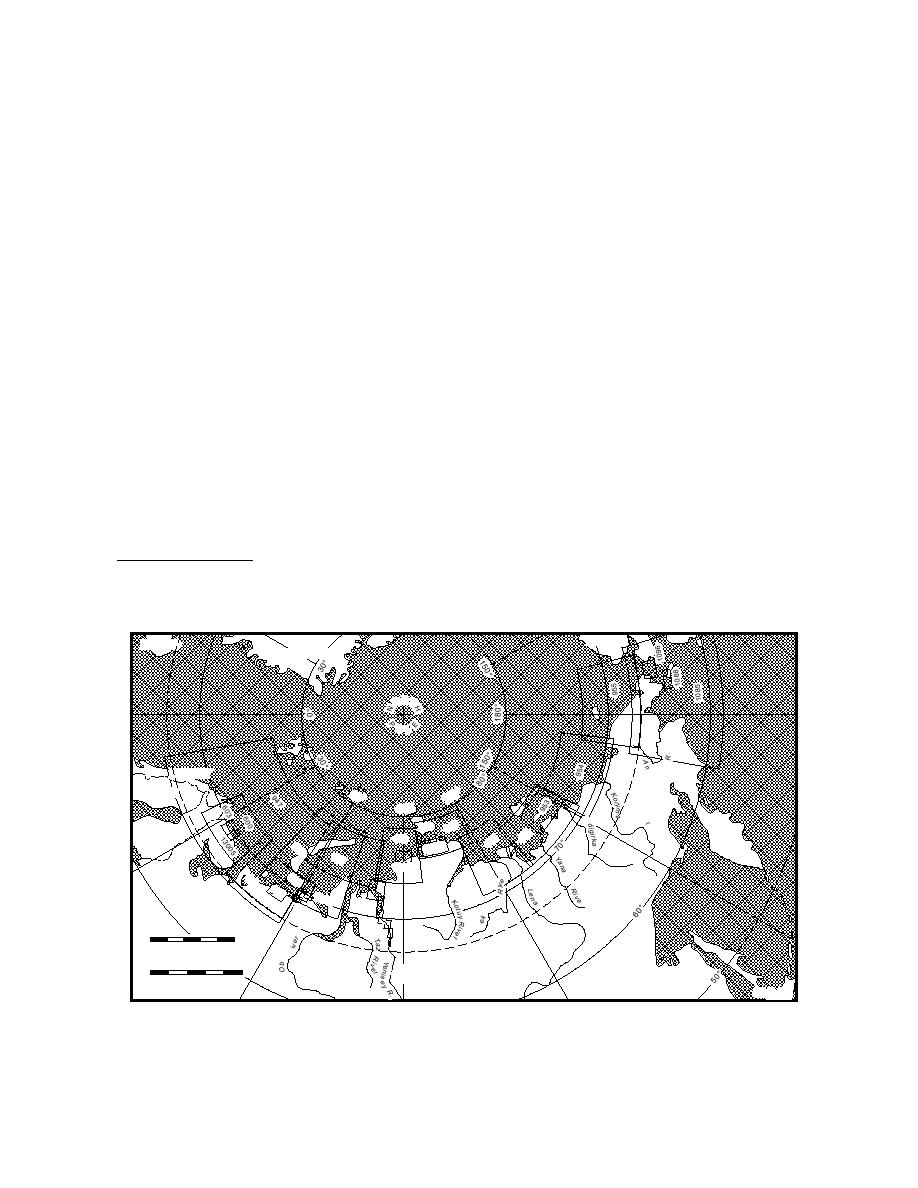
between 1:100,000 and 1:700,000. Figure 24 is an
ern Sea Route, personal communication.
Alaska
ICELAND
GREENLAND
ORT
OL
a d yr
NORWAY
0
60
SWEDEN
12
90
In
e
Riv
949
950
52
FINLAND
948
1
9
95
69
2
1233
6
69
Ri
7
ver
12330
65
69
r
5
0
61
7
133
17
698
r
13
02
8
River
en
Ol
945
0
500
E
CL
IR
C
s
Nautical Miles
R
IC
ARCT
0
1000
R
U
S
S
I
A
Kilometers
JAPAN
Figure 24. Declassified Russian hydrographic charts for the NSR, as of November 1993. Refer to chart number
in Appendix D for a description of each map.
37


 Previous Page
