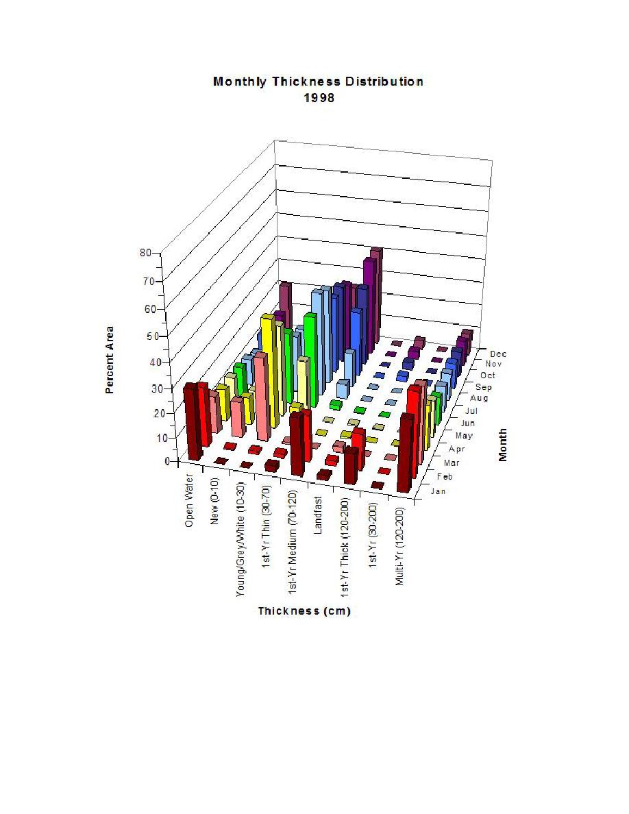
Figure 12. Monthly sea-ice thickness distribution for the Ross Sea in 1998.
Summary
This paper discusses the use of ArcGIS in the analysis of sea-ice thickness in the Ross
Sea that is part of a larger NSF project. A continental-scale dataset with sea-ice information is
compared with in situ ship-based observations to ascertain its quality for monitoring sea-ice
thickness and mass balance changes in the Southern Ocean. The extent and variability of sea-ice


 Previous Page
