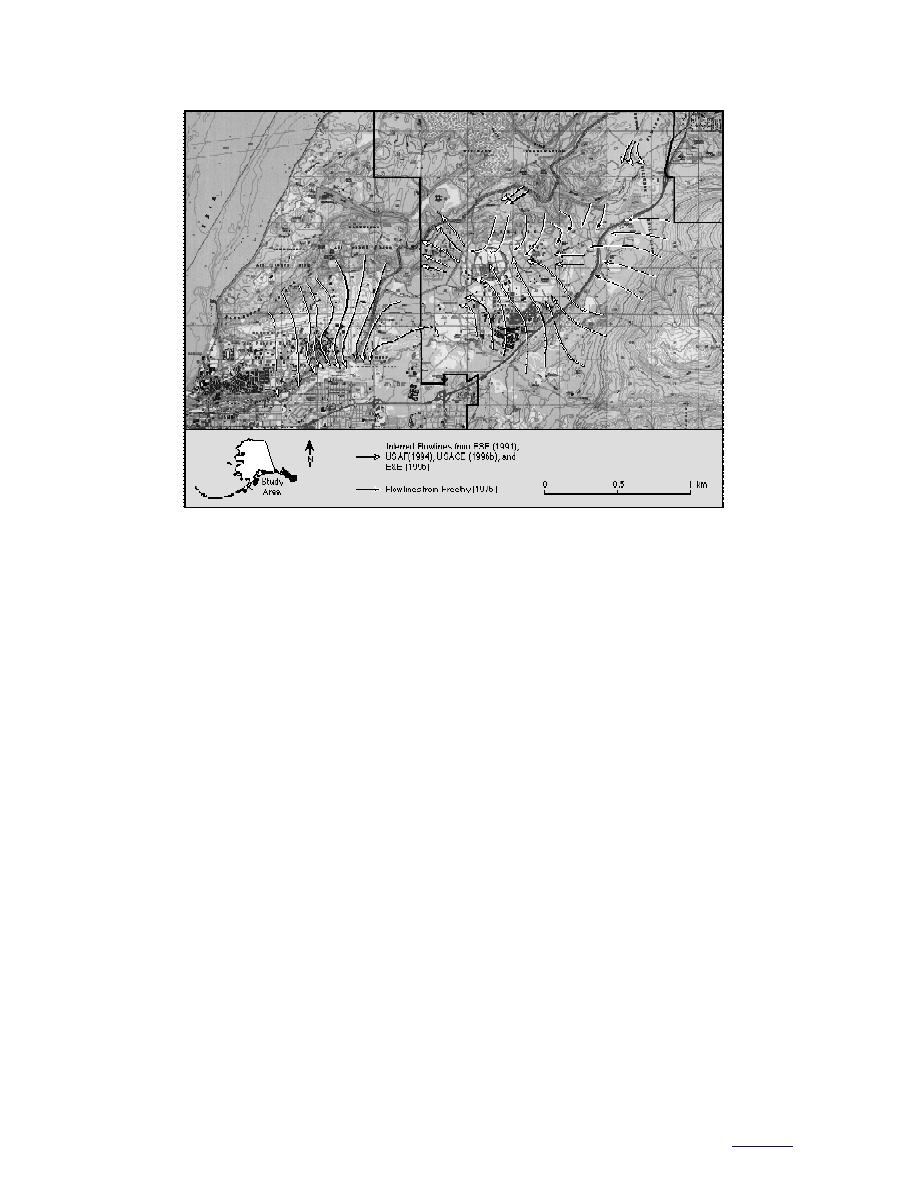
Figure 20. Comparison of ground water flow patterns. White flow arrows are inferred from ESE
(1991), USAF (1994), USACE (1996b), and E&E (1996). Black flow arrows are from Freethy (1976).
(USACE 1996b), is found at a shallower depth
but it is clearly important to understanding how
than the unconfined aquifer (Fig. 15ac, g).
ground water moves and contaminants migrate in
Although this appears to be a product of the
the cantonment area and Operable Unit D (OU D).
boundaries chosen for contouring, it introduces
The elevation of the water table (unconfined
serious implications to future modeling, since
aquifer) was monitored three times in 1995 and
this situation cannot exist in nature. Further
used to contour the water surface below the can-
investigation is needed to resolve this issue, espe-
tonment area (Fig. 15). Some interesting changes
cially since it directly affects the modeling of con-
in the configuration of the water table and associ-
taminant transport in OU D (ENSR 1996).
ated flow paths took place. Generalized flow pat-
Monitoring of the confining aquifer during the
terns during each of these periods (May, August,
same period shows a general tendency for north-
November) were to the northwest, reflecting
westerly flow (Fig. 15df). Along a line from AP-
recharge from Ship Creek. During relative low
3479 to the north side of Building 740 (approxi-
flow (low recharge) conditions in May, there
mately parallel to flow), the gradient of the
appears to be a strong divergence in flow near the
potentiometric surface was approximately 0.0155
intersection of the Davis Highway and Loop
for all measurement periods. The 61- and 76-m
Road. The divergence is probably controlled by
contours almost replicate those proposed by
the upper topography of a confining layer. There
Cederstrom et al. (1964). There appears to be only
may also be flow divergence caused by a zone of
minimal seasonal or long-term change in the con-
high hydraulic conductivity below the Mountain
fined aquifer.
View fan deposits in the vicinity just west of Loop
Data indicate that along the northwest edge of
Road. In August, under higher recharge condi-
the cantonment, the unconfined aquifer plunges
tions, flow lines are still divergent but tend to
form broad arcs that are more consistent and sub-
and recharges a deeper aquifer (Fig. 15a). Based
parallel, with discharge towards the north just
on the ground water data from AP-3471 and AP-
east of the railyard loop and westerly near Loop
3472 (USACE 1996b), it appears likely that at least
Road.
some of this water reenters a confined aquifer
One problem that we have observed is that the
and continues flowing to the northwest under-
top of the confining layer, as defined by the Corps
neath the Elmendorf Moraine. More data are
28
to contents


 Previous Page
