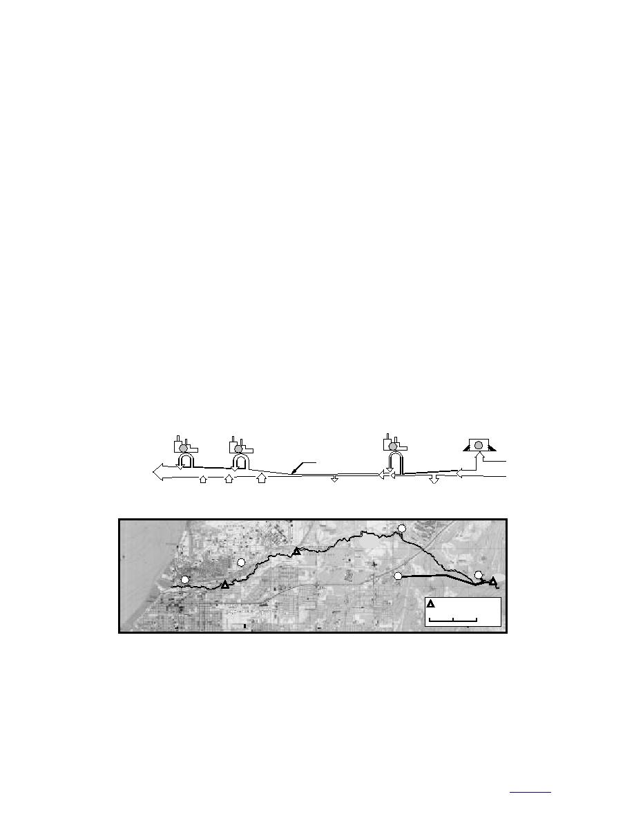
stream; Fig. 25). USAF (1994) treats the Bootleg-
westerly in May and August to northnorthwest
ger Cove Formation as a boundary to the west,
in November. Contaminants reaching the ground
where it reportedly rises below the coastal bluffs
water table in this region would form a broad
and limits westerly flow.
plume.
Ground water surface maps currently propose
conflicting models for Fort Richardson (Fig. 20).
CONCLUSIONS
According to Freethy (1976), the crest of the
Elmendorf Moraine acts as a flow divide and
The hydrogeology of Fort Richardson is far
causes convergent flow below the northern area
more complicated than that of Anchorage and
of the cantonment along the front of the moraine.
neighboring Elmendorf Air Force Base. Defining
The unconfined aquifer mimics surface topogra-
the boundary conditions is particularly difficult.
phy and flows from the high elevations along the
In both of the other areas, the Bootlegger Cove
Elmendorf Moraine and the front of the Chugach
Formation forms a relatively continuous blanket
Mountains. Below the cantonment, these topo-
that behaves as a flow boundary to the upper
graphically driven flows encounter water mov-
unconfined aquifer. Flow across Elmendorf Air
ing north in response to recharge from Ship
Force Base is generally north to south (Fig. 18 and
20), with ground water recharge from the Elmen-
Creek. Flow convergence would produce a west-
erly flow in the unconfined aquifer and high dis-
dorf Moraine and discharge to the lower reaches
charge along the front of the Elmendorf Moraine
of Ship Creek. Therefore, both the Elmendorf
towards Elmendorf Air Force Base. However,
Moraine and Ship Creek can be treated as flow
because the unconfined aquifer plunges north-
divides (north and south, respectively). To the
ward below the cantonment, this flow instead
east, flow circulates counter-clockwise in the
probably recharges the deeper confined aquifer
vicinity where Ship Creek shifts from a losing
beyond the eastern limit of the Bootlegger Cove
stream (where it recharges the aquifer) to a gain-
Formation.
ing stream (where the aquifer discharges into the
Chugach
Fort Richardson
Elmendorf A.F.B.
Electric
Powerplant and
Powerplant and
City and Military
Powerplant
Fish Hatchery
Fish Hatchery
Water Treatment Plants
1
2
4
3
49,210
3,785
11,356
30,283
15,142
79,493
7,571
56,781 m3/day
at Dam
11,356
3,785
7,571
7,571
15,142
30,283
18,927
Loss
Gain
Gain
Gain
2
Ship
Creek
3
1
1
Dam
4
USGS Gaging Station
0
1
2 km
Figure 25. Major water diversions along Ship Creek, showing shift from a losing channel on
Fort Richardson to a gaining channel on Elmendorff Air Force Base. (After Barnwell et al.
1972.) 1The combined capacity of the treatment plants is 64,352 m3/day. During the lowest flow
days nearly every year, they cannot operate at full capacity. 2Fort Richardson powerplant uses
nearly all of the low flow in the stream for cooling and returns warm water to the channel. 3
Elmendorff Air Force Base's powerplant uses most of the low flow for cooling, then returns it to the
channel. During the low flow months, the stream is supplemented with well water. 4The
it to the channel.
33
to contents


 Previous Page
