0 ns
bly the Bootlegger Cove Forma-
tion. A deep well drilled at the
200
northern edge of the cantonment
400
(well 1; Cederstrom et al. 1964)
600
penetrated about 97 m of unconsol-
Raw Data
idated sediment prior to encoun-
800
tering bedrock. The upper 15.2 m,
0m
with its base at elevation 83 m asl
(above sea level), consisted of
12
sandy gravel in Mountain View fan
24
Channel Fill
deposits. The next 40 m (base at 43
Silty Sand and Gravel
Fluvial
36
Diamicton
m asl) was described by Ceder-
and Gravel
(Mountain View Fan)
Sand
Processed Data
strom et al. (1964) as till; however,
the properties of this horizon could
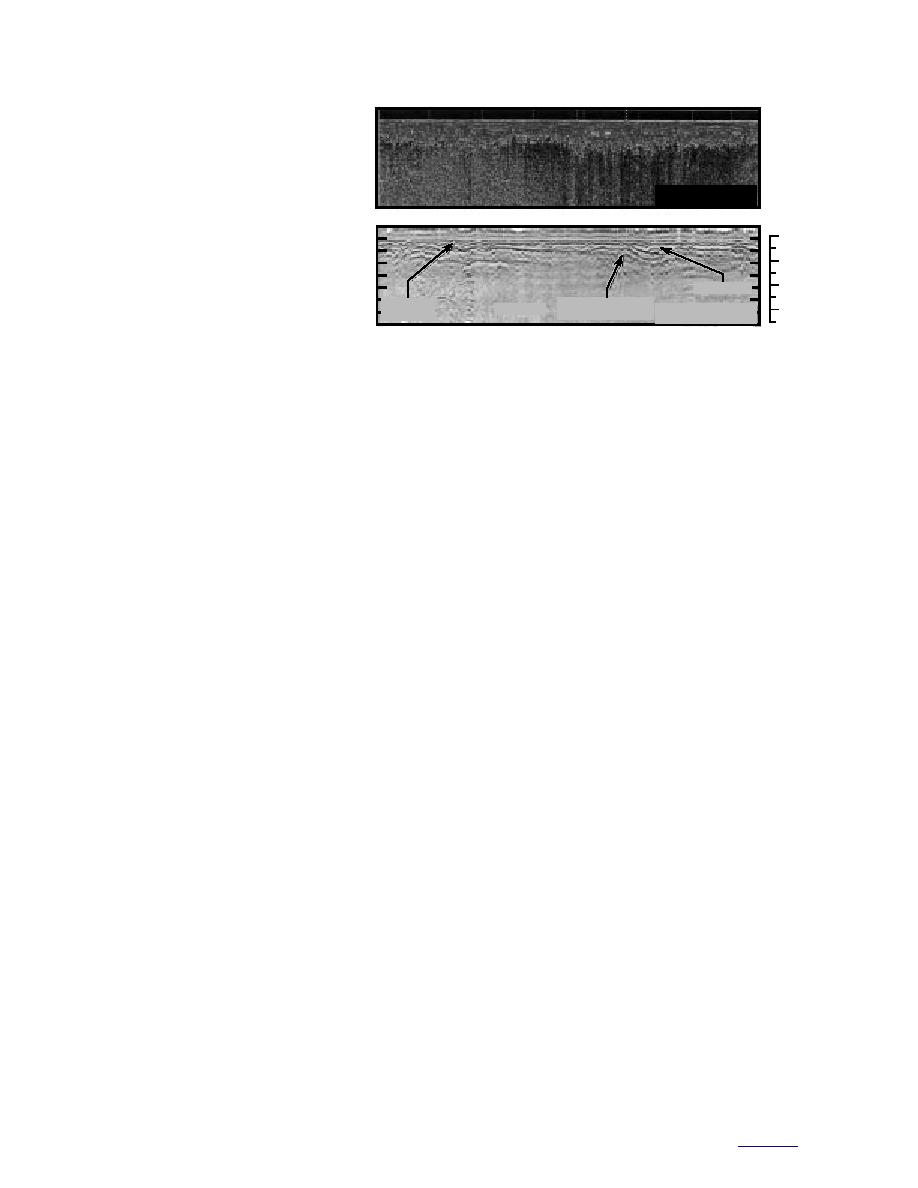
Figure 16. 50-MHz radar profile collected along Loop Road showing a
also be attributable to a glacial-
shallow, gently dipping reflector at the interpreted base of Mountain
marine silt.
View fan.
The USACE (1996b) defined the
top of the unconfined aquifer at 52
to 55 m asl, at what would be almost 30 m within
Road, where a similar reflector dips to a depth of
this diamicton. A diamicton was also encoun-
20 m (Fig. 16) (Strasser et al. 1996). The signal is
tered 4 m below the surface (85 m asl) near the Fort
probably lost below the horizon through attenua-
Richardson powerplant (well 17; Cederstrom et al.
tion in the silty matrix of the confining layer. The
1964). This diamicton was interbedded with sand
overlying 10 to 20 m of sediment is sand and
and gravel down to 17 m depth (61 m asl). Hills
gravel of the Mountain View fan. Again, this hori-
nearby this well site have been mapped as drum-
zon roughly agrees in elevation with the top of
linized ground moraine of Dishno Pond age
the diamicton at well 17 and may be the top of a
(Plate 1; App. A). These hills are relict landforms
once-continuous diamicton bed. This stratum
that project through deposits of the Mountain
may be absent at well AP-3591 because of local
View fan and this may be a lateral extension of
dissection during flooding on the fan. Also, pro-
the diamicton in the powerplant area.
glacial streams migrating across the front of the
The the two diamicton horizons in wells 1 and
advancing Elmendorf ice may have eroded and
17 (Cederstrom et al. 1964) top out at approxi-
dissecated the sediments. Therefore, the perched
mately the same elevation (83 to 85 m asl), which
ground water zones encountered in wells could
might suggest that a more or less continuous
simply be locally confined by remnants of the
sheet of diamicton once extended below the can-
diamicton (Fig. 17a). At places where the diamic-
tonment. However, at the southern edge of the
ton has been eroded, a gravel aquifer extends to
railyard loop, AP-3591 penetrated 46 m of gravel
great depth (e.g., AP-3591). If the diamicton was
down to 50 m asl (Fig. 9). Although its silt content
actually continuously eroded along the front of
increased at depth, a diamicton was not encoun-
the moraine, then the location of the dipping
tered. We must assume that the confining layer
water surface near the Davis Highway and Loop
does not exist here. Nearby, wells AP-3184 and
Road (Fig. 15a) could be its northern limit.
AP-3470 encounter perched or unconfined
Another plausible alternative is that the diam-
ground water at 96 to 98 m asl, respectively. This
icton observed in well 1 formed as a result of
is 12 to 15 m above the diamicton in wells 1 and
debris flows from the Elmendorf Moraine. Evi-
17. Unfortunately, these wells did not penetrate
dence, such as erosional features (clay rip-up
through the impermeable confining layer (at AP-
clasts) at the base of the diamicton, supports this
3184, drilling was stopped just after ground
concept, as do observations along modern glacier
water was encountered), and so we cannot deter-
margins. The silty deposits may be a transitional
mine the thickness of the diamicton or whether
phase of the Bootlegger Cove Formation, with the
the lower diamicton extends across the area.
clay balls being recycled material from marine
Ground-penetrating radar profiles along Arc-
silty clay eroded to the north. If this is the case,
tic Valley Road near here show a strong reflector
the diamicton encountered in well 17 is from a
between 5 and 10 m below the surface that
separate source and would either have to dip to
appears to extend to Davis Highway and Loop
the north and west underneath the cantonment,
25
to contents


 Previous Page
