120
90
60
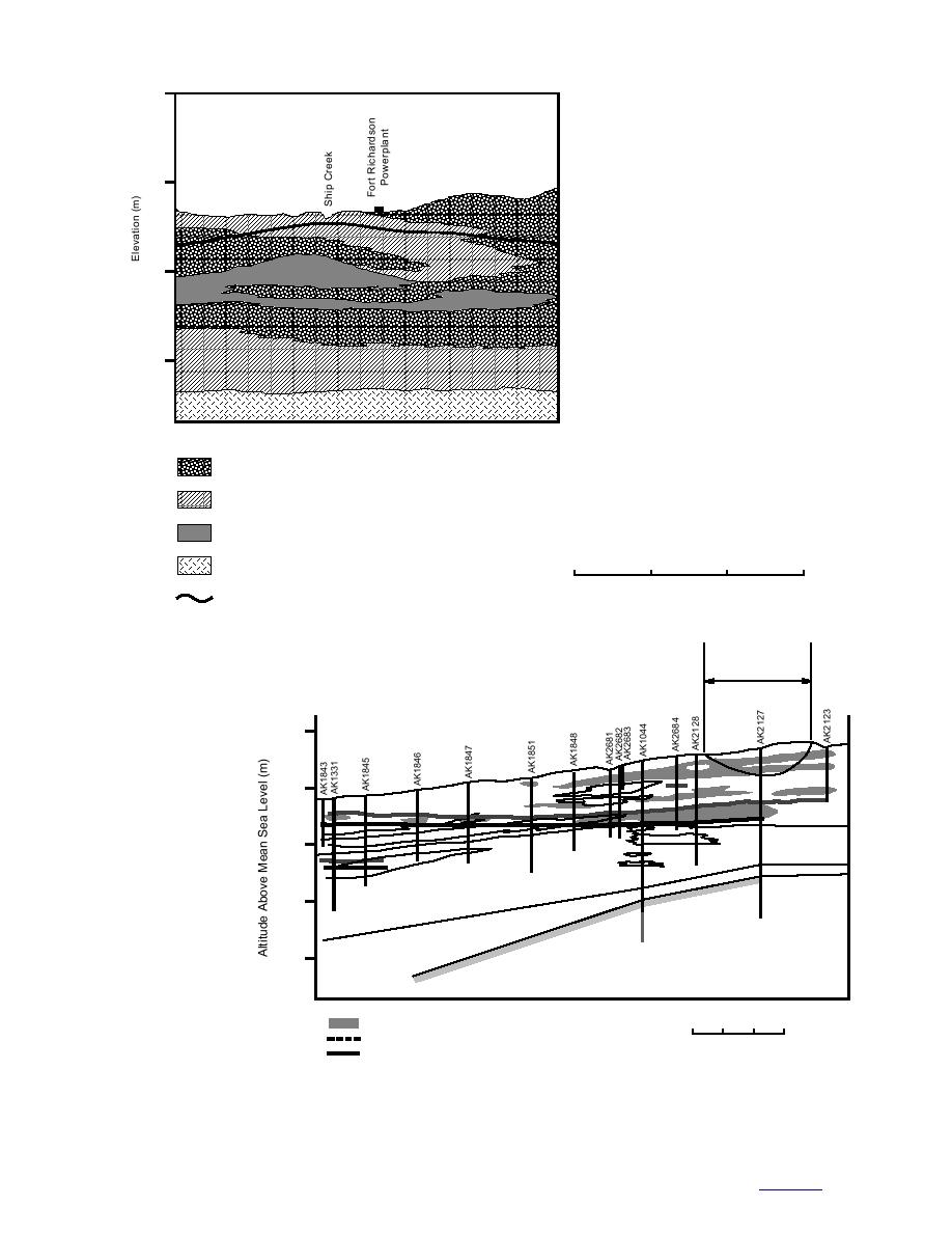
b. Interfingering relationships of strati-
graphic units near the Fort Richardson
powerplant along an eastwest transect.
(After Freethy 1976.)
30
Vertical Exaggeration x20
Datum is Mean Sea Level
Permeable water-bearing zone
Semi-permeable zone (functions as a confining unit in
some places and as a water-bearing unit in others)
Confining zone (generally impermeable -- functions as
a ground-water barrier)
0
500
1000
1500 m
Bedrock (Kenai formation)
Water table (may be under pressure where shallow aquifer
is semi-confined)
Projected
Recharge Basin
West
East
120
100
SG
SSG
SG
SSG
SG
SG
SSG
80
Clay
c. Interfingering rela-
Gravel
nd
Sand a
60
tionships of strati-
graphic units near the
)
tion
Till
a
Fort Richardson power-
Form
i
ena
40
(K
plant along a north
rock
Bed
south transect. Grey pat-
tern shows moist zones
recorded with neutron
Zone of Relative Moisture Change
0
100
200
300 m
logs that reflect silt-rich
Water Levels, after Recharge
horizons. (After Ander-
Water Levels, before Recharge
Vertical Exaggeration x10
son 1977.)
Sand and Gravel
SG
Silty Sand and Gravel
SSG
Figure 12 (cont'd). Cross-sections along Ship Creek.
18
to contents


 Previous Page
