North Bend
Fremont
Hwy. 30
NW
&
C
Hwy. 30
Union Pacific
No
and
R
.R.
rth
Big Island
west ern
Morse
WASHINGTON
go
Chica
Bluff
COUNTY
USGS
Ice
DODGE
Gages
Pole
Jams
COUNTY
Island
Hwy. 36
Mercer
Ford Farm
DOUGLAS
SANDERS
Leshara
COUNTY
COUNTY
Valley
64
y.
Hwy. 64
Un
Hw
ion
Waterloo
Paci
fic
Venice
Sokol
Camp
Hwy. 77
Hwy. 92
Two
Union Pacific R.R.
Rivers
Hwy. 92
R.R.
.
No
.R
rn
cR
rth
e
ifi
ern
rth
ac
No
nP
UP
io
Un
R.R.
Thomas
Lakes
Camp
Vencil's
Ashland
0
5 miles
Island
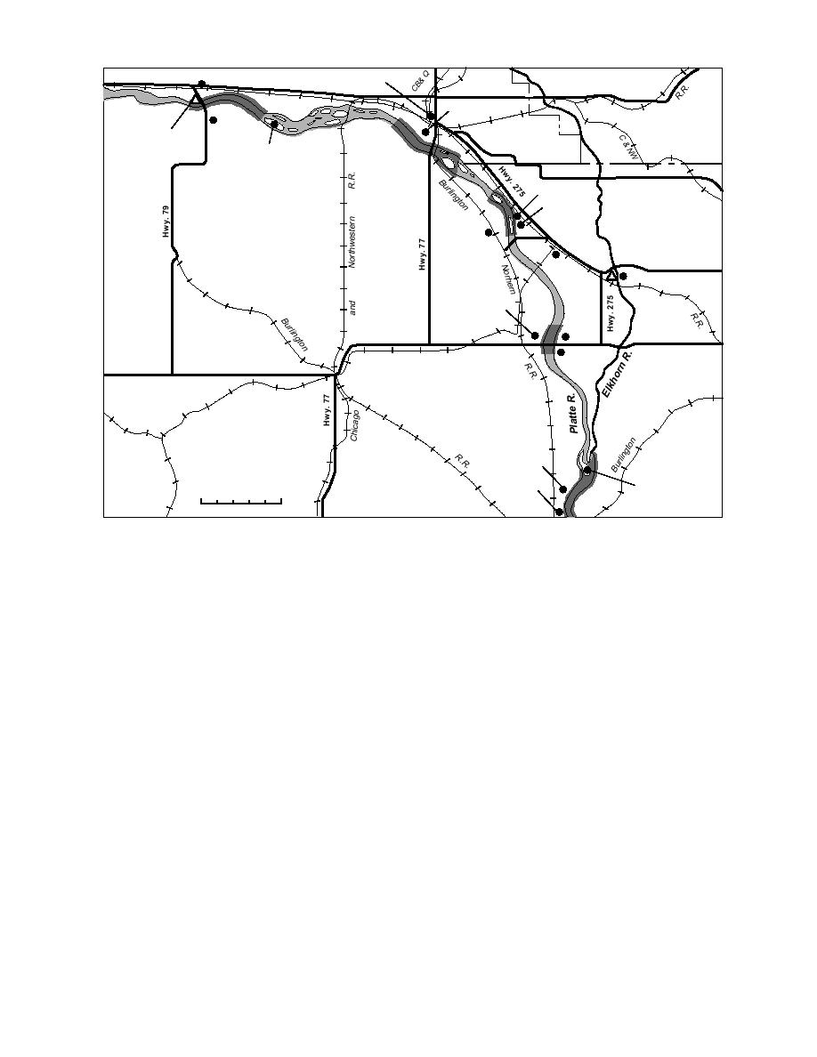
Figure 5. Identified recurring ice jam sites on the Platte River between North Bend and Ashland.
ously since 1949. Ice jams have been reported at
recurring ice jams. According to local residents
the gage in 1971, 1972 and 1978. In addition, peak
the jams initiate at a point about 22.5 miles down-
annual stages caused by backwater from down-
stream from the Highway 79 bridge, in the reach
stream ice have occurred at the North Bend gage
upstream from Pole Island (Fig. 5). Ice-jam-relat-
relatively frequently--in 19501953, 1955, 1958
ed flooding occurs primarily in the Morse Bluff
1963, 1970, 1974, 19761977, 19791980, 19821983,
area, but lowland flooding could occur on both
19851986 and 19881989.
sides of the river. Ice jams have also been noted
The flood stage at this gage, 8 ft, has been ex-
upstream from the Highway 79 bridge, but data
ceeded during the period of record by 14 ice-re-
are sketchy. For example, Nebraska Civil Defense
lated events, 11 of which occurred between 1971
records report that an ice jam located about 1.75
and 1989 (Fig. 6, Table 6). Using the difference
miles upstream from the bridge in February 1980
between recorded stage and flood stage as a mea-
resulted in lowland flooding, but no other infor-
sure of severity, it appears there has been a trend
mation about the jam (i.e. location of toe, length,
toward more severe ice events in recent years.
stages) was available. In February 1982, ice jams
However, more detailed information about events
were located both upstream and downstream from
within and outside the period of record, as well as
the bridge. Sandbagging of the levee in the
changes in observers and observation methods,
McGinn's Lake area about four miles west of North
would be required to verify this apparent trend.
Bend was begun when backwater from the jam(s)
In addition, changes in river morphology and
approached within six inches of the top of the
property development patterns may also affect
levee.
stages.
A USGS gaging station is located on the left
The maximum stage recorded at the North
bank of the river just upstream from the Highway
79 bridge. This gage has been operated continu-
Bend gage was 15.55 ft on 19 March 1978, during
10


 Previous Page
