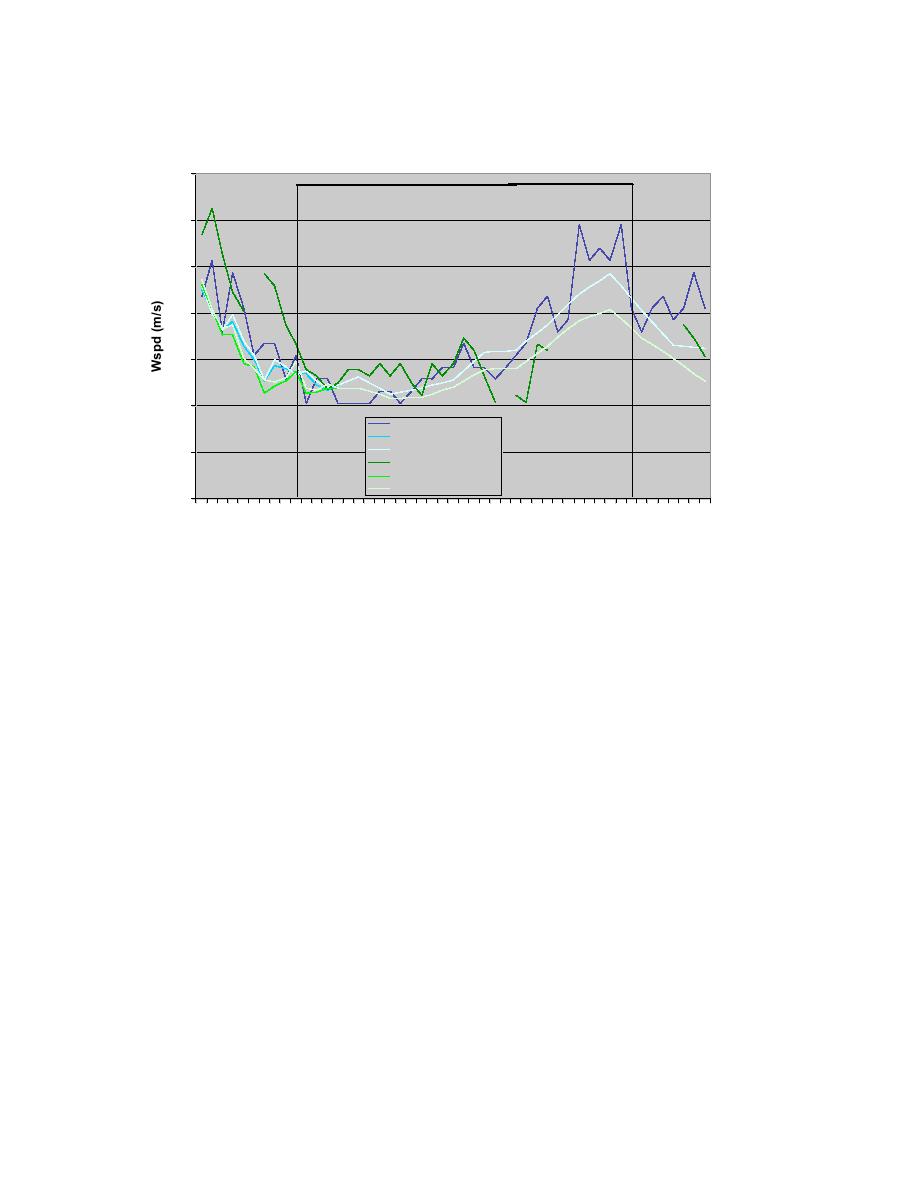
Wind Speed Comparison for Jan 26, 2004
14
AMW OB
12
10
8
6
4
AMW METAR OB
AMW METAR wFSL
AMW METAR woFSL
2
AMW RWIS OB
AMW RWIS wFSL
AMW RWIS woFSL
0
18 20 22 0
24
6 8 10 12 14 16 18 20 22 0 2 4 6 8 10 12 14 16 18
Time (UTC)
Jan 26, 2004
Jan 27, 2004
Fig. 10.17. Same as Fig. 10.15, except for wind speed (m/s).
As mentioned above, snow started falling in the Ames area around 03 UTC on 26
January. A few radar images are included, corresponding to the times of the surface
maps, to demonstrate the progression of the snow throughout the event (Figs. 10.12,
10.18). A time series chart of the forecasts of probability of precipitation (POP) and
quantitative precipitation forecast (QPF) indicate the forecasted start and stop times of the
event as predicted 9 hours before the actual start time (Fig. 10.19). The RWFS uses POP
and QPF thresholds of 25% and 0.1 mm/hr, respectively, to determine when precipitation
will fall.
42


 Previous Page
