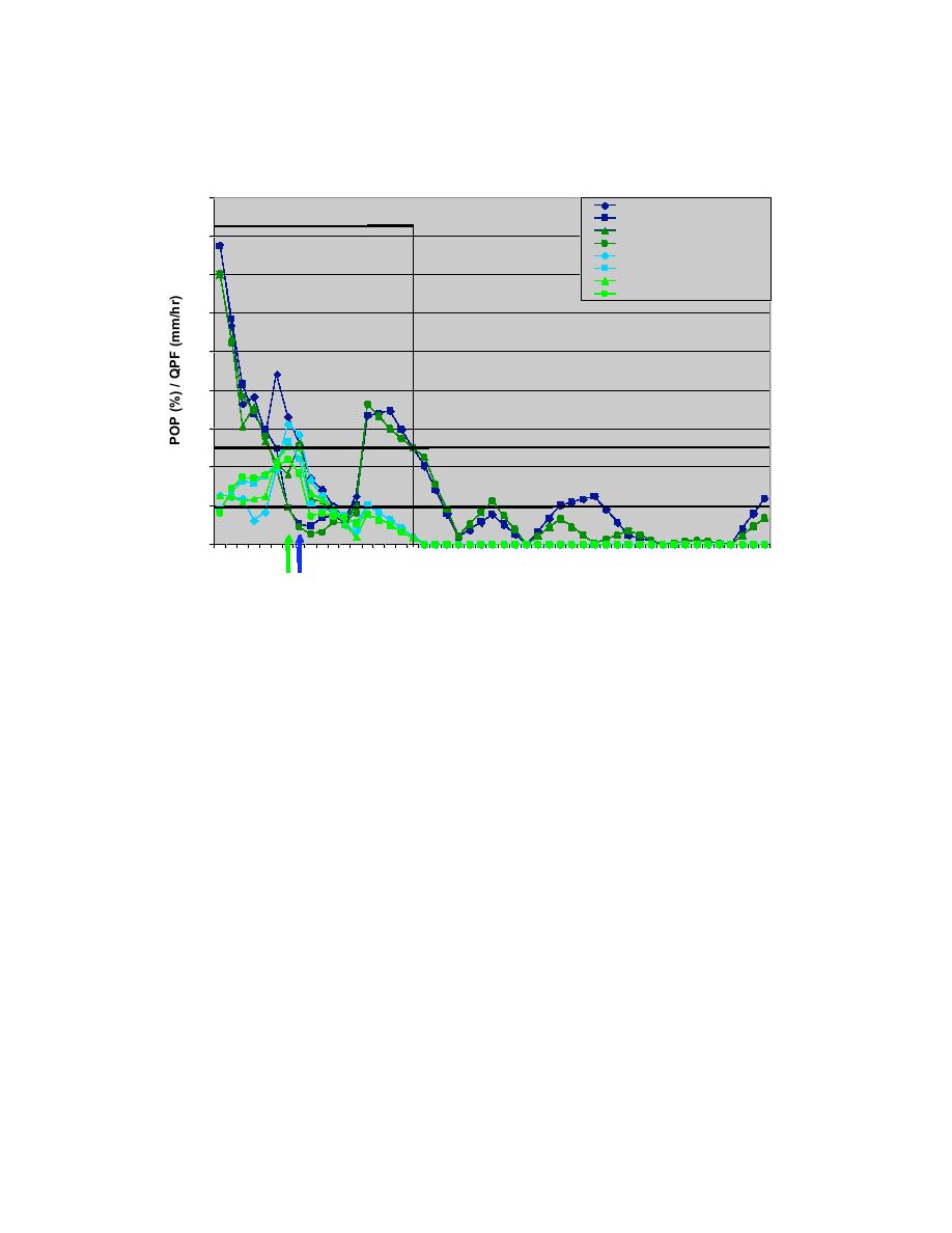
POP and QPF for End Time Jan 26, 2004
0.9
AMW METAR POP wFSL
AMW OB
AMW METAR POP woFSL
AMW RWIS POP wFSL
0.8
AMW RWIS POP woFSL
AMW METAR QPF wFSL
AMW METAR QPF woFSL
0.7
AMW RWIS QPF wFSL
AMW RWIS QPF woFSL
0.6
0.5
0.4
0.3
POP Threshold
0.2
QPF Threshold
0.1
0
18 20 22
0
2
4
6
8
10 12 14 16 18 20 22
0
2
4
6
8
10 12 14 16 18
METAR/RWIS wFSL End
Jan 28, 2004
METAR/RWIS woFSL End
Fig. 10.20. Same as Fig. 10.15 except for probability of precipitation (%)
and quantitative precipitation forecast (mm/hr) for the 18 UTC 26
January RWFS run. The blue arrows indicate the forecasted end time
(with FSL) for the METAR and RWIS sites and the green arrow indicates
the forecast end time (without FSL) at the METAR and RWIS sites.
The NWS office forecasts for 1 PM CST on 25 January (18 UTC) called for a winter
weather advisory through Monday.
.REST OF TODAY...CLOUDY. HIGH IN THE MID 20S.
.TONIGHT...BLUSTERY. CHANCE OF SNOW THEN SNOW AFTER
MIDNIGHT. SNOW ACCUMULATION OF 2 TO 5 INCHES. LOW 10 TO 15. EAST
WIND 15 TO 25 MPH.
.MONDAY...SNOW LIKELY. SNOW ACCUMULATION UP TO 2 INCHES.
TOTAL SNOW ACCUMULATION 8 INCHES. HIGH 15 TO 20. NORTHEAST WIND
15 TO 20 MPH. PRECIPITATION CHANCE 70 PERCENT.
.MONDAY NIGHT...CHANCE OF SNOW IN THE EVENING. LOW ZERO
TO 5 ABOVE. NORTH WIND 15 TO 20 MPH. PRECIPITATION CHANCE 30
PERCENT.
.TUESDAY...MOSTLY SUNNY. HIGH 15 TO 20. WEST WIND 10 TO 20
MPH.
The start time forecast by the NWS was fairly close to the actual start time of the
precipitation with the wording "a chance of snow" changing to "snow after midnight".
The snow began around 10 PM CST (03 UTC, 26 January). The end time was forecast to
45


 Previous Page
