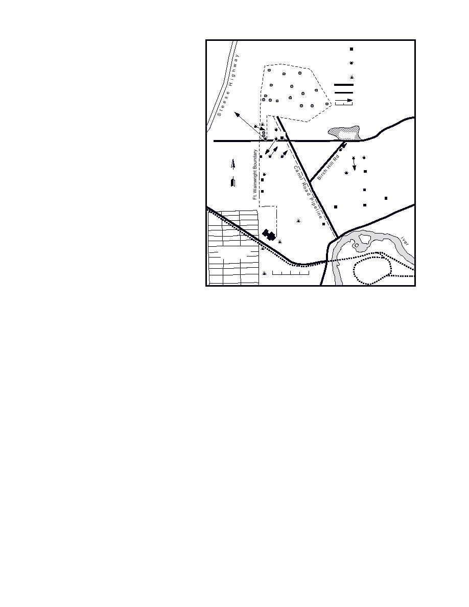
CONCLUSIONS
Completed Sub-
Birch Hill
permafrost Well
Hydrogeological conditions are ex-
Completed Shallow
tremely complex within the Canol Road
Monitoring Well Cluster
Picket Well
area because of the complex distribu-
Tank Farm
Road
tion of aquifers within the discontinu-
Railroad
ous permafrost. Aquifers occur within
Ground Water Flow Vector
the unfrozen materials above (supra-
2 Measuring Velocity (m/day)
0
permafrost), below (subpermafrost) and
C-12
ad
within (intrapermafrost) the imper-
Ro
C-1
ll
Hi
meable, permanently frozen alluvial
P-1
Quarry
h
C-5
rc
Bi
sediments. Zones that are completely
C-2
unfrozen from the surface into the bed-
C-6
C-7
C-9
C-3
C-4
rock interconnect the supra- and subper-
P-2
mafrost aquifers. Near-surface flow gen-
N
P-3
C-11
C-8
erally takes place in suprapermafrost
P-10
aquifers within deeply thawed, dis-
P-4
P-5
P-18
turbed areas, where the top of perma-
frost lies at depths ranging from a few
P-9
P-7
Rd
er
meters to over 15 m, as well as within
Riv
unfrozen former swales or channels. In
P-0
School
Che n
a
R
addition, areas where materials are
deeply frozen and possess only thin ac-
Tr
ai
Shannon Park
no
tive layers interrupt the continuity of
rG
Subdivision
ate R ad
o
the subpermafrost aquifer, as well as
ROLF
confine or isolate suprapermafrost aqui-
0
200
400 m
fers from unfrozen zones. In particular,
a zone to the east and southeast of the
c. 30-m wells.
site severely limits communication of
Figure 19 (cont'd).
ground water with the aquifer further
south near the Chena River.
Seepage measurements with flow sensors in
water movement and the fate and transport of
monitoring wells for the period of October 1994
contaminants. Simple water table elevation
to January 1995 indicate that flow directions at
measurements from wells across the area that are
the 30-m depth were consistently to the south
commonly taken quarterly or monthly at some
southwest. At the 10- and 20-m depths, flow is
sites cannot be used to develop a hydraulic
much more variable in orientation and velocity.
gradient and predict site-specific flow patterns.
This variability reflects the effects of permafrost
Site-specific flow patterns often differ signifi-
and its configuration. Seepage data suggest that
cantly from the general subregional flow pattern.
the local gradient is responding to a hydraulic
Therefore, measurements that consider the effects
gradient north of the site, including Birch Hill.
of permafrost provide accurate data on ground
These limited data suggest that ground water
water movement and site specific movements and
movement within the Canol Road area is mainly
should be used to analyze contaminant fate or
controlled by local water sources and hydraulic
migration.
gradients. The overall directions of flow are there-
Potential pathways for contaminant migration
fore not the same as the subregional pattern of
include 1) unfrozen former channels trending both
westerly to northwesterly flow. Rather, they trend
eastwest and northsouth across the site, 2) the
mainly south to southwest in the subpermafrost
subpermafrost aquifer above bedrock where it is
aquifer. Directions may vary greatly from site to
interconnected with the unfrozen zones and the
site within unfrozen zones surrounded by perma-
unfrozen southern slope of Birch Hill, and 3) near-
frost. Northeastsouthwest trending zones tend to
surface, suprapermafrost aquifers within dis-
have a southwesterly flow, while eastwest trend-
turbed areas of Canol Road, Lazelle Road, Birch
ing zones show mainly easterly flow directions.
Hill Road, the Tank Farm and the Truck Fill Stand.
These results are critical to predicting ground
Our initial data suggest that the migration of con-
21


 Previous Page
