Birch
Hill
1173
Pf
Pf
Pf
Pf
Pf
Equipotential
Lines
Bedrock
Near Surface Flow
Near Surface Flow
Subsurface Flow
Subsurface Flow
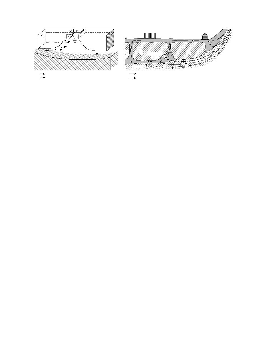
Figure 17. Idealized subpermafrost and suprapermafrost flow
Figure 16. Potential interaction and flow direc-
patterns associated with an aquifer within the bedrock in Birch
tions between a subpermafrost aquifer and an un-
Hill. Flow below the permafrost responds to the hydraulic
frozen zone, such as a former swale or channel.
gradient of Birch Hill. Flow that trends EW is the result of
permafrost confinement in unfrozen former channels.
ers' alluvium or a bedrock aquifer associated with
within the unfrozen channel deposits that are sur-
Birch Hill (Fig. 15). In either case, the constraints
rounded by permafrost, and include both east
of permafrost are relevant. Barriers caused by per-
west and northsouth trending features. Sub-
mafrost extending into bedrock will affect flow
regionally controlled directions will be mostly
patterns for both scenarios, resulting in mainly a
northward in the northsouth unfrozen zones
northsouth trend, the actual direction respond-
south of the Truck Fill Stand, while mostly north
ing to the local gradient. A system dominated by
northeast in the subpermafrost aquifer (Fig. 14).
flow from water within the bedrock in or below
We anticipate southerly flow in these unfrozen
Birch Hill (referred to hereafter as the localized
zones and southwesterly in the subpermafrost
aquifer within Birch Hill) would result in subsur-
aquifer if the localized aquifer within Birch Hill
face flow that generally parallels the direction of
controls the local hydraulic gradient. This sce-
slope, resulting in upward directed flow after
nario of interacting aquifers in determining flow
passing beneath permanently frozen materials
patterns is consistent with deep (30 m) flow mea-
(Fig. 17). Also relevant to this scenario are the
surements made during the early winter period
down-gradient water table fluctuations that re-
of 199495.
spond to stage fluctuations in the Chena River,
thus affecting the ultimate baseline and hydraulic
gradient between the Canol Road OU-3 sites and
SEEPAGE MEASUREMENTS
the Chena River in the downtown Fairbanks area.
We consider it probable that both the subre-
Limited measurements of ground water flow
gional Chena and Tanana river system aquifer
with the CRREL prototype system suggest that
and the localized aquifer within Birch Hill signifi-
patterns within the study area for the early to
cantly affect ground water flow directions and
mid-winter period of October 1994 to January
seepage velocities in the Tank Farm and Truck
1995 mainly respond to locally generated hydrau-
Fill Stand area. Moreover, the dominance of one
lic gradients interacting with the impermeable
system over the other may vary seasonally in
permafrost (Table 1).
response to changes in runoff and infiltration of
During early to mid-winter, water levels were
snowmelt or rain. We expect seasonal periods of
slowly falling while seepage directions and ve-
little to no flow within the unfrozen channel de-
locities remained relatively constant to slowly fall-
posits, as well as in deep thaw zones above the
ing (Table 1). Seepage velocities, based upon the
permafrost.
calibration to a no. 812 sand mixture, typically
In addition, the effects of the subregional aqui-
ranged from 0.5 to 1 m/day, with maximum val-
fer on subpermafrost flow may vary seasonally,
ues of 1.7 to 2.6 m/day measured in two 10-m-
in some cases raising water levels within the Canol
deep wells (Table 1). These isolated higher values
Road area and perhaps inducing reversals in flow
may reflect localized controls on water movement,
direction. Changes will be most pronounced
or perhaps inaccuracies for a particular well at-
16


 Previous Page
