rock. Permafrost constraints on
?
ground water flow include 1) the
Tank
Farm
extensive area east and south-
?
west of the site where perma-
?
frost extends into the bedrock,
2) the zone of permafrost that is
frozen to bedrock within the up-
N
per half of the Truck Fill Stand
?
area, 3) the relatively limited oc-
?
currence and configuration of
?
unfrozen zones above bedrock,
?
4) the shallow depth of annual
thaw over areas immediately ad-
?
jacent to the Tank Farm, Truck
?
?
?
Fill Stand and Canol Road pipe-
line, and 5) the depth and thick-
?
?
ness of the subpermafrost aqui-
???
fer peripheral to the site (Fig.
10a and b). Surface and near-
surface flows are also influenced
by the topography, including
such factors as the steep ravine
and slope of Birch Hill, the mor-
phology of former swales and
channels that cross the area, and
active layer thickness, which will
Subregional Aquifer Dominance
affect the volume and rate of sur-
Subsurface
face runoff (Fig. 10a).
Subpermafrost
We considered two scenarios
Birch Hill Aquifer Dominance
of the Canol Road area hy-
Subsurface
drogeology to be possible. The
Subpermafrost
first assumes that localized aqui-
Unfrozen
fers within Birch Hill and local
climatic events (e.g., precipita-
d
Permafrost Present to
tion, spring runoff) are the pre-
100 m
an Unspecified Depth
dominant water sources deter-
Permafrost Generally Extends
mining ground water flow
Through Sediments into Bedrock
Tr
d
patterns and rates. The second
ainor Gate R
at an Unspecified Depth
assumes that the subregional
aquifer associated with the
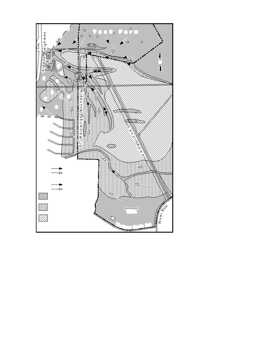
Figure 14. Potential near-surface flow paths depicted for two scenarios: a
Chena River is the most impor-
hydraulic gradient dominated by the subregional aquifer and a more local
tant control on site-specific flow
system dominated by Birch Hill. The resultant direction and velocity of flow
patterns. As will be discussed
for each scenario differ significantly in both the subpermafrost aquifer and
briefly later, the interaction of
in unfrozen zones linked to it. Map made from unrectified aerial photo-
both systems probably deter-
graphs taken on 20 May 1993. Interpretations are based upon GPR and
mines ground water conditions
borehole data and ground observations.
north of the Chena River.
Potential pathways for near-
surface ground water movement and the possible
GROUND WATER
connections into unfrozen zones, and thus the
FLOW PATTERNS
subpermafrost aquifer, are shown relative to the
The movement of ground water in the Canol
shallow characteristic depths of thaw on Figure
Road area will reflect the confining and bounding
14. The near-surface ground water system is lo-
conditions imposed by the permafrost and bed-
cated above permafrost where the thaw zone is
14


 Previous Page
