GREENLAND
Alaska
M
Less than 50 m depth
Bering
S
ea
ore than 50 m depth
2
C hS k c h i
u
ea
Provideniya
ORT
S Mys
hmidta
OL
Pevek
ARCTIC
OCEAN
a d yr
NORWAY
0
60
SWEDEN
12
90
nd
e
Riv
FINLAND
Murmansk
Magadan
v er
Tiksi
St. Petersburg
Nordvik
r
Arkhangel'sk
Dikson
Khatanga
O ea of
S
r
ek
Dudinka
khotsk
River
Salekhard
Noril'sk
0
500
E
Yakutsk
CL
Yamburg
Igarka
IR
C
Nautical Miles
R
IC
ARCT
0
1000
R
U
S
S
I
A
Kilometers
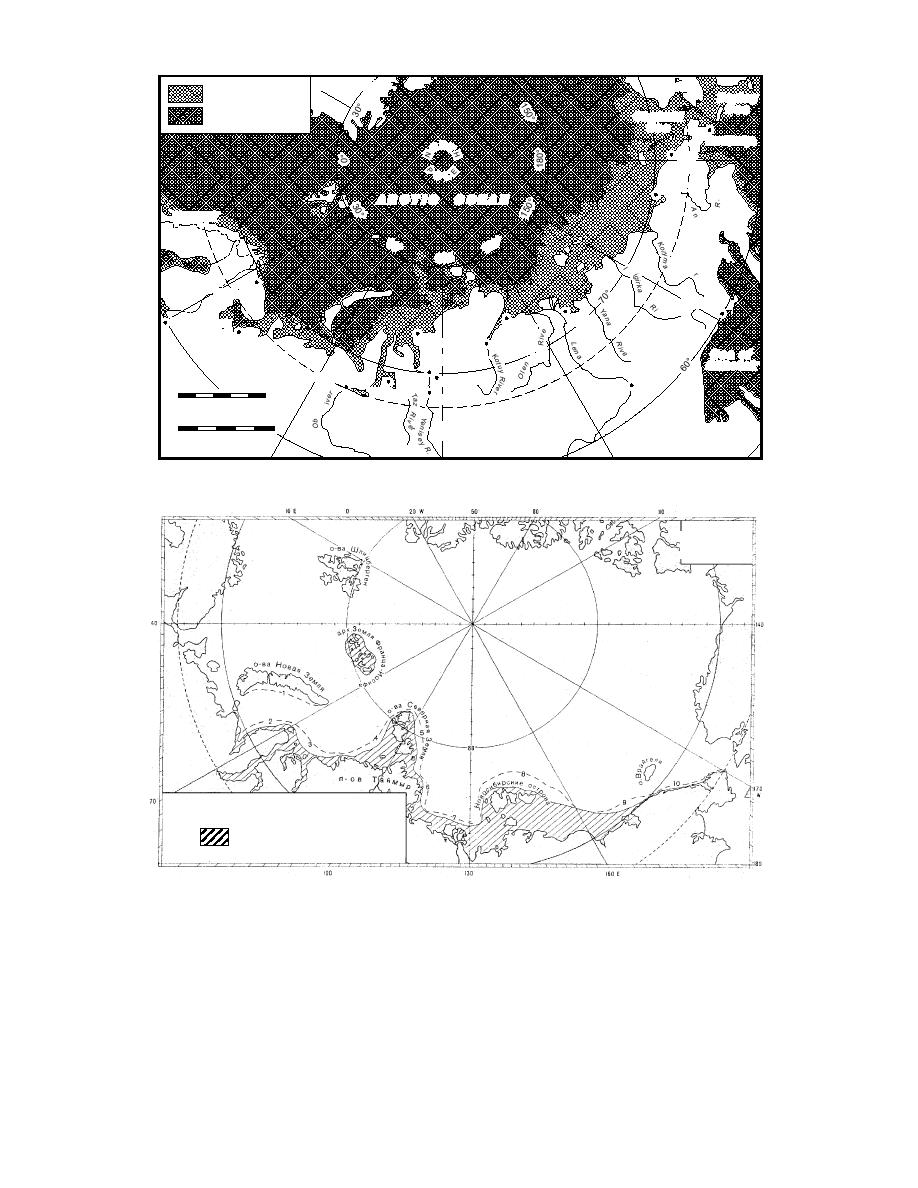
Figure 13. The bathymetry of the Russian Arctic.
MayJune
6
Polynya Number
Shore-fast ice
Figure 14. Location of offshore and recurrent open water areas, or "polynyas," during the time of
maximum ice development (May to June). (Translated from RSMOT, in prep.)
sin at the time of maximum ice development (May
vives the summer season. These ice fields, or mas-
to June). In the areas of convergence, rubble ice
sifs, sometimes cover hundreds of square kilome-
refreezes into much thicker and stronger masses.
ters and are found in the same regions every sum-
In some places, due to the presence of land barri-
mer. Figure 16 shows the location of nine such
ers, prevailing winds, currents, and so forth, ice
massifs along the Northern Sea Route. They all
accumulates in large enough masses that it sur-
experience some degree of seasonal fluctuation in
2


 Previous Page
