EM 1110-2-2907
1 October 2003
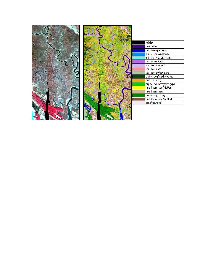
Figure 5-16. Landsat image (left) and its corresponding thematic map (right) with 17 the-
matic classes. The black zigzag at bottom of image is the result of shortened flight line
over-lap. (Campbell, 2003).
(1) Supervised Classification. Supervised classification requires some knowledge
about the scene, such as specific vegetative species. Ground truth (field data), or data
from aerial photographs or maps can all be used to identify objects in the scene.
(2) Steps Required for Supervised Classification.
(a) Firstly, acquire satellite data and accompanying metadata. Look for infor-
mation regarding platform, projection, resolution, coverage, and, importantly, meteoro-
logical conditions before and during data acquisition.
(b) Secondly, chose the surface types to be mapped. Collect ground truth data
with positional accuracy (GPS). These data are used to develop the training classes for
the discriminant analysis. Ideally, it is best to time the ground truth data collection to
coincide with the satellite passing overhead.
(c) Thirdly, begin the classification by performing image post-processing tech-
niques (corrections, image mosaics, and enhancements). Select pixels in the image that
are representative (and homogeneous) of the object. If GPS field data were collected,
geo-register the GPS field plots onto the imagery and define the image training sites by
outlining the GPS polygons. A training class contains the sum of points (pixels) or poly-
gons (clusters of pixels) (see Figures 5-17 and 5-18). View the spectral histogram to in-
spect the homogeneity of the training classes for each spectral band. Assign a color to
represent each class and save the training site as a separate file. Lastly, extract the re-
5-30


 Previous Page
