Tanana
Rive
rR
ipa
ria
n
Fens
Buttes
Lowlands
Buttes
Blair Lakes
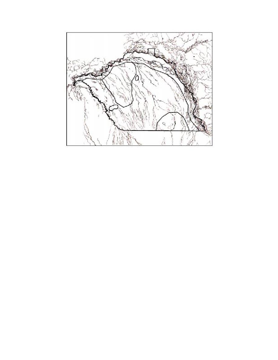
Figure 8. Subdivision of Tanana Flats into floristic inventory units based mainly
on landforms.
rock project abruptly from the surrounding allu-
western portion of the YMA and 381 m (1250 ft)
vial Lowlands unit (Pewe 1975) (Fig. 11 and 12).
on the east (Fig. 5 and 7). In the northeast corner
Although small in total area, these features are sig-
of the YMA, the Lowlands unit includes the Chena
nificant because of their xeric, south-facing,
River lowlands. In this area, the relatively flatter
nonforested slopes that contain steppe-like com-
valley terrain abuts the abruptly steeper Slope
munities.
Forests unit (Fig. 5).
3. Fens unit--A wetland area in the northwest
2. Slope Forests unit--The most extensive area
corner of Tanana Flats comprising a unique area
in the YMA; it includes slopes from the treeline
of wetland fens (Racine and Walters 1994) con-
downslope to approximately 229 m (750 ft) on the
sisting of extensive, floating, vegetated mats (Fig.
western side and 381 m (1250 ft) on the east, where
13). The area lies northwest of Clear Creek Butte
most slopes intercept the abruptly flatter Lowlands
between Crooked Creek, Salchaket Slough, and the
unit terrain (Fig. 5).
Tanana River.
3. Alpine unit--Several isolated summits occur-
4. Lowlands unit--The largest unit of Tanana
ring from treeline at approximately 685 m (2250
Flats, formed from a complex of ancient alluvial
ft) to summits as high as 996 m (3265 ft) on the
fans that extend from the Alaska Range north
east side of the YMA (Fig. 9).
to the Tanana River (Fig. 14). A low gradient and
Five subdivisions of the Tanana Flats area were
little topographic relief, coupled with the presence
recognized based mainly on the types of landforms
of permafrost and groundwater springs, results in
present (Fig. 8):
large expanses of swampy, boggy wetlands sur-
1. Blair Lakes unit--An upland area at the
rounding the Fens, Buttes, and Blair Lakes collect-
southern edge of the Tanana Flats representing an
ing units.
area surrounding three large lakes (Blair Lakes)
5. Tanana River Floodplain unit--Area largely
and a series of low hills near the southeastern
influenced by riverine processes paralleling the
boundary of Tanana Flats (Fig. 10).
Tanana River and consisting of the channel islands,
2. Buttes unit--A small unit consisting of the
backwaters, floodplains, and terraces of the river
Wood River Buttes and Clear Creek Butte. These
(Fig. 4).
isolated knobs of igneous and metamorphic bed-
8


 Previous Page
