3
5 1
5 x 10³
terial was redeposited into the area
70
of the Brisco scour monitor. Thus,
at this single point there was a
60
4
net loss of 5 in. of bed material.
Following the survey, the drop-
50
ping foot was repositioned at the
3
nominal bed elevation and the
40
electronics were reset. If the loss
across the cross section is assumed
30
2
to be uniform, a considerable
amount of material has been re-
20
moved. The size distribution of
1
the gravel redeposited adjacent to
10
the pier is shown in Figure 23.
In January 1993, fifteen instru-
0
0
mented fish were buried in the
0
2
4
6
8
10
12
14
16
18
20
22
24
26
28
gravel upstream of the Route 5
Ice Load (kips)
bridge pier. The fish were each
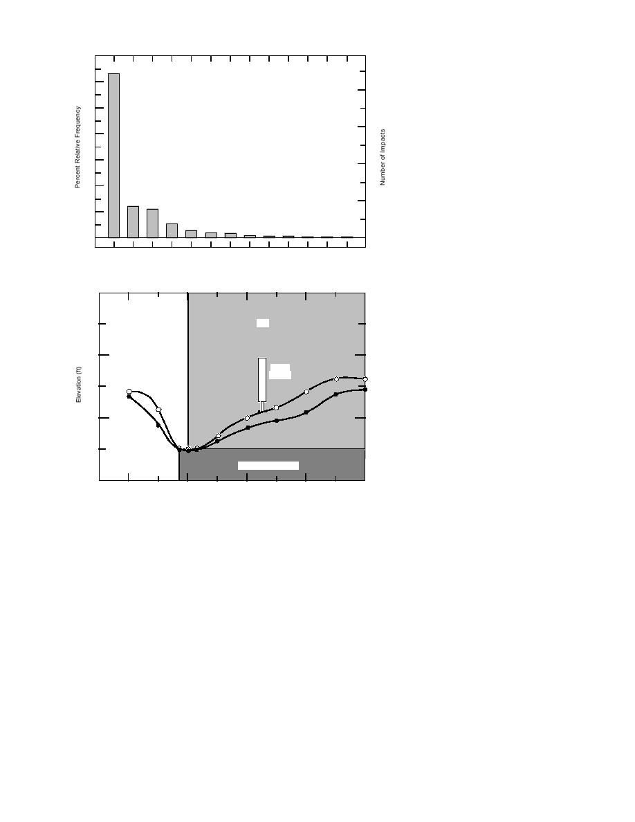
Figure 20. Impact load frequency distribution for 1992.
attached to one of four masts, at
6-in. vertical spacing on alternate
330
sides of the mast using ball-bearing
swivel connectors (Fig. 24). The ar-
Pier
rangement of the fish is shown in
Figure 25.
Three to five fish were attached to
328
Brisco
the 1-in.-diameter mast, depending
Monitor
on the location and the anticipated
Oct `91
depth of scour around the mast. The
overall length of the mast was 8 ft,
Jul `92
with the bottom portion used to de-
326
velop lateral support and anchoring
for the upper instrumented section,
which could be cantilevered into the
Footing (elev: 325.0)
flow and exposed to the current and
debris. The four masts, or "fish poles,"
324
10
0
10
20
30
were installed in the riverbed using
Length from Pier Nose (ft)
compressed air and equipment (Fig.
Figure 21. Bed profile adjacent to the Route 5 bridge pier, October
26). The outer driving shell reduced
1991 and July 1992.
the amount of material that slumped
back into the excavation. The inner
driving shell was slightly larger in diameter than
Erosion-scour measurements
In November 1991 a Brisco scour monitor was
the mast with attached fish. Because the air probe
installed on the channel side of the left pier (Fig.
fluidized the bed, the inner driving shell easily
7) about 14 ft back from the nose. Before the Bris-
sank into the bed. Material within the driving
co scour monitor was installed, the bed adjacent
shell was ejected by using a blast of compressed
to the pier was profiled using a sounding rod
air at the bottom of the driving shell, with supple-
(Fig. 21). During the April rains, with no ice in
mental air from the air probe. With a cavity for
the river, the foot on the Brisco scour monitor
the instrument fish, the mast was jetted into the
dropped 11 in. During low water in August 1992,
riverbed using the compressed air.
the river bottom adjacent to the pier was sur-
While the instrumented fish were being in-
veyed. The elevation contour lines of the bottom
stalled, the following observations were made.
are shown in Figure 22. The profile adjacent to
First, the upper 2 ft of material in front of the pier
the pier is overlaid on the October 1991 profile
was very loose, giving little resistance to the driving
(Fig. 21). An interesting point is that 6 in. of ma-
shell. At the 2-ft level, there was a hard layer,
14


 Previous Page
