two or three CRREL personnel familiar with the data-
base and methodology. To see how well the methodol-
ogy could be used by others to determine ground snow
loads, CRREL trained five practicing licensed SENH
engineers in the case study methodology and 20 case
studies were done by both groups. This pilot study
showed that comparable results could be achieved
when the groups shared ideas. CRREL and SENH then
entered into a Cooperative Research and Development
Agreement (CRDA) to determine ground snow loads
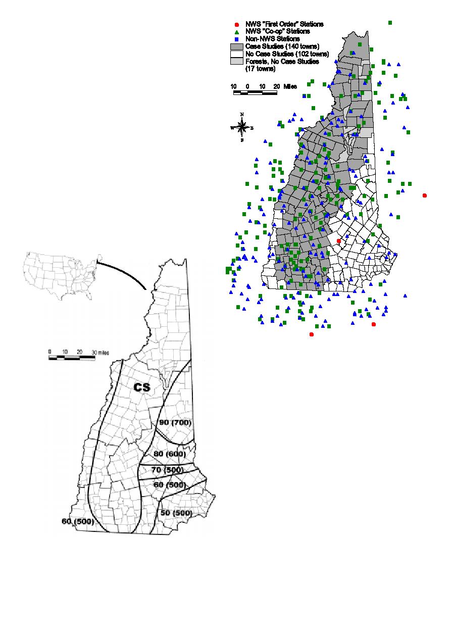
for the 140 New Hampshire towns in the "CS" zone;
17 other towns in that zone in portions of the White
Mountain National Forest where little or no construc-
tion is to be expected were not studied. We did not do
case studies for the remaining 102 towns where, as
shown in Figure 1, ground snow load values up to a
limiting elevation are available on the map in ASCE
7-95. We reasoned that we did not wish to develop
values that might contradict mapped values in ASCE
7-95. We have subsequently changed our minds on this
point, as will be discussed.
F
Numbers in parentheses
represent the upper el-
evation limits in feet for
the ground snow load
values (lb/ft2) presented
alongside.
igure 2. State of New Hampshire showing stations where ground
snow load information is available and where our case studies
were and were not done. (To convert miles to km, multiply by
1.609.)
2 ESTABLISHING CASE STUDY LOCATIONS
United States Geological Survey (USGS) 1:24000
scale topographic maps of the state were used to de-
termine the coordinates of the geographical center, not
the population center, of each town to the nearest
minute of latitude and longitude. Those maps show
town boundaries as well as roads and buildings. We
did not use the elevation of the geographical center as
the case study elevation but, instead, determined six
elevations for each town: (1) lowest land; (2) lowest
building; (3) lower limit of most buildings; (4) upper
limit of most buildings; (5) highest building; and (6)
highest land. Significant elevation differences exist
within most towns. Thus, each ground snow load an-
Figure 1. State of New Hampshire showing town and county
swer would not be a single value for all places in a
boundaries overlaid with the ground snow load information in
town but a value at the case study elevation and an
ASCE 7-95. (To convert lb/ft2 to kN/m2, mulitply by 0.0479, for
elevation factor for correcting that value to other el-
miles to km, multiply by 1.609, and for ft to m, multiply by
evations in that town.
0.3048.)
314


 Previous Page
