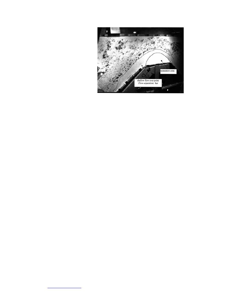
The details of the LSPIV
technique are described by
Ettema et al. (1997). In brief,
the technique entailed use
of a CCD camera for mak-
ing videotapes of flow and
ice movement in the conflu-
ence. The CCD camera was
set 5.4 m above the model
at an oblique angle, so that
its view encompassed the
confluence (see, for exam-
ple, Figure 44 for a sample
view). The whole field of
flow in the confluence was Figure 44. Video camera view of open water flow through
d e t e r m i n e d from video modeled confluence of the Mississippi and Missouri
records of the movement of Rivers. The model replicates the bathymetry given on
black beads (the same ma- USACE charts.
terial used for the model ice) sprinkled sparsely as tracer particles over the flow.
The whole field of model ice movement was determined in the same manner, ex-
cept that additional tracer particles were sprinkled on the layer of model ice drift-
ing into the confluence. The additional tracers were small white polypropylene
squares. To enhance the resolution of the recorded images the bottom of the con-
fluence was spray-painted white.
The video images from the CCD camera were recorded using a Sony EVO-9650
video recorder, and digitized using a frame-grabber (Matrox Meteor RGB). The
digitized images (i.e., video frames) comprised 640 480 pixels of 8-bit, gray-level
resolution. A 133-MHz Pentium personal computer was used to process and store
digitized video images. Custom software, written in the C language, was used to
control the VCR and the frame-grabber during playback and frame grabbing. The
subsequent image processing software, essentially a cross-correlation algorithm
including software to correct the aerial distortion of the video image, was written
in Fortran 77. A standard color monitor was used for on-line display of the video
imaging.
Model calibration and validation
Model calibration entailed adjustment of flow elevations to match flow rates
through the confluence, and it entailed adjustment of model ice discharge rate to
provide a single layer of model ice drifting over practically the full width of the
modeled channel of the Missouri River. These calibrations required adjustment of
the tailgate elevation to get the required flow elevations, adjustment of belt speed,
and gate opening of the ice-feed hopper to obtain the required ice discharge rate.
A further calibration task required checking the accuracy of the LSPIV system.
This task simply entailed comparing PIV velocities with those measured by tim-
ing hand-released tracers as they moved known distances in the model. As the
dimensions of the area of interest and the period between images are preset, ve-
locities follow directly. In actuality, this calibration step is not needed, but it pro-
vides additional confirmation of the PIV measurements. For the present model-
ing, the LSPIV proved not to be as useful as hoped. Inadequacy of lighting created
a difficulty in distinguishing the model ice pieces, which are black, from the back-
52
Go to contents page


 Previous Page
