Alaska
ICELAND
GREENLAND
Bering
S
8
trait
ORT
7
OL
NORWAY
SWEDEN
60
3B
6B
F2
6A
6
0
Murmansk
4
FINLAND
23
2A
5
3A
2
R
U
S
S
I
A
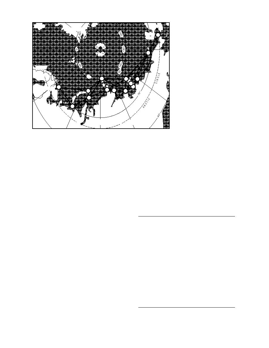
Figure 4. NSR overlain with
meshing scheme.
execution of NSRSIM01 begins during the same
torical data, we assumed that each leg leading
tenth of a second in two different years.
away from a decision node has an equal probabil-
ity of being selected. A more detailed view of the
Mesh description
entire mesh pattern, identifying all data nodes,
Figure 4 offers a map of the Russian Arctic,
appears as Figure 5. Not all routes are used dur-
showing the set of route alternatives programmed
ing all months; in some cases the probability as-
into the model. We segmented the various route
signed to a given leg is zero. Appendix D gives
choices with a mesh of data nodes, which are gen-
the specific routing diagrams used for each of the
erally spaced 250 nm apart. These nodes are mesh
four months simulated and shows which legs may
points where the navigation conditions are set for
or may not be active. A complete listing of nodal
an upcoming trip segment and are associated with
points is given in Table 4.
the major climatological regions (Table 3) along
the NSR (Treshnikov 1985, The Soviet Arctic 1970,
Table 3. Regional subdivisions of the NSR.
RSMOT in prep., Proshutinsky et al. 1994).
Decision nodes, shown as circled numbers in
Region
Description of the region
Figure 4, are similar to data nodes in that we up-
1
Ice edge--Franz Josef Land
date the environmental conditions of the voyage,
2
Ice edge--Cape Zhelanya
but they have the additional feature of marking
3
Ice edge--Karskiy Vorota Strait
where two or more route choices exist. That is,
4
Karskiy Vorota Strait--Cape Kharasavey
where the choice is made to follow the coastal
5
Cape Kharasavey--Belyi Island--Dikson
6
Mouth of the river Ob'
route or a more northerly variant. For example,
7
Mouth of the river Yenisey
from decision node 0 at the mouth of the Kolskiy
8
Cape Zhelaniya--Dikson
Gulf (43 nm seaward from Murmansk), we can
9
Dikson--Cape Cheluskin
choose to skirt Novaya Zemlya either to the south
10
Dikson--Sedova Island
11
Cape Arkticheskii--Vil'kitskogo Strait--
(to node 2) or to the north (to node 2A). We will
Khatanga River--Tiksi Bay
refer to voyage segments between consecutive de-
12
Tiksi Bay--Novosibirskiye Straits
cision nodes as legs (leg 02 and leg 02A in this
13
Novosibirskiye Straits
example).
14
Laptev Strait--Indigirka River--Kolyma River
15
Kolyma River mouth
Route options are selected using MC methods.
16
Kolyma mouth--Cape Shelagskiy
Nodes files(NDESEW**.DAT and NDESWE**.DAT,
17
Cape Shelagskiy--De Long Strait
App. B) give probabilities that particular legs will
18
De Long Strait--Bering Strait
be followed, based on NSR historical data sup-
19
Wrangel Island--Bering Strait
20
Bering Strait
plied by RSMOT (in prep.). In the absence of his-
10


 Previous Page
