dard age designations are omitted from map sym-
represents a sequence of several glaciations. Some
bols because all units except bedrock are of Qua-
of these deposits are found in stratigraphic
ternary age. The correlation of map units is shown
sequences exposed in bluffs along Knik Arm and
on Figure A3.
locally in exposures along streams and in roadcuts.
Except for the uppermost one or two, most of the
deposits in these sequences cannot be directly
Surficial deposits
Surficial deposits underlie the surface of the
related to the deposits mapped at the surface. The
Anchorage Lowland and extend to depths of tens
deposits at the surface occur in well-defined land-
to at least 100 m (mainly west of the map area). They
forms and include extensive areas of moraine and
consist mostly of Pleistocene-age glacial drift that
related glacioalluvial, glaciolacustrine, and glacio-
a.
b.
50
50
emd
40
40
emg
emd
30
30
eoa
doa?
20
20
emk
emd
eoa
bc?
bc
bc
dmg
dmg?
oe?
10
10
dmg?
oa?
og
d
doa?
ib
od
ogx
ogx
ib
0
0
1
2
9 10 3
4
5
6 11
7
8
12
c.
50
emd
emd
40
emd
emd
emg
emd
emg
30
emd
ec?
ec?
ec?
20
eoa
eoa
doa? dmg?
bc
10
oe
og?
og
ogx
0
ib
pi
10
oei
13
1415 16 17
18
19
20
21
d.
50
40
emk
ek
emg
ec?
ek
30
emk
cw
?
emg
eoa
emg
emg
ec
20
eoa
eoa?
bc
bc
10
kd?
kd
og
ib
0
22 23
24
25
26
27
28
29
30
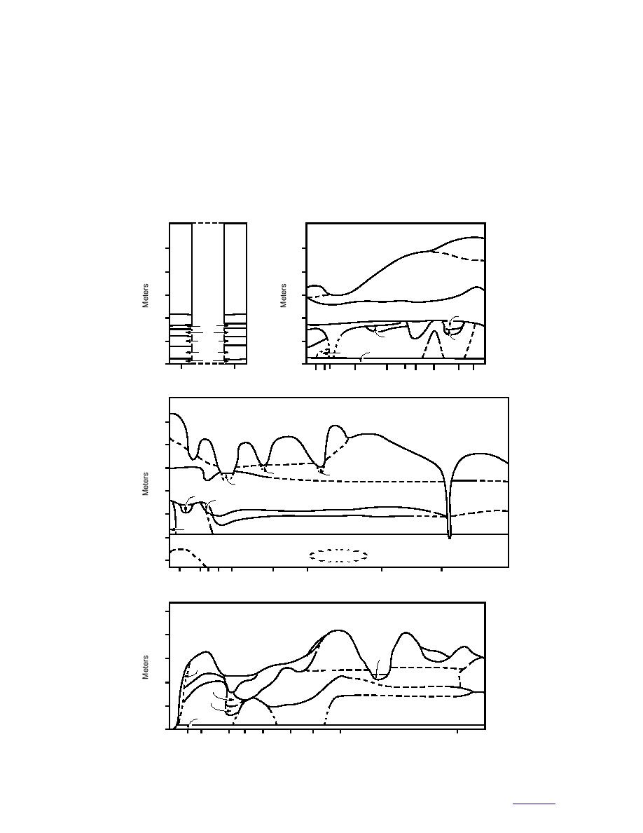
Figure A3. Generalized stratigraphy exposed in bluffs along Knik Arm.
to contents


 Previous Page
