APPENDIX A: DESCRIPTION OF MAP UNITS
Additional detail in some other areas was de-
Introduction
The material in this appendix is a draft report
rived by Schmoll and Yehle from these airphotos
on the surficial geologic units of Fort Richardson
as well.
prepared by H.R. Schmoll and L.A. Yehle of the
The geology of the lowland area was included
U.S. Geological Survey. This section contains their
in previous mapping at smaller scales by Dobro-
most recent classification scheme and should be
volny and Miller (1950), Miller and Dobrovolny
used when referring to the surficial geologic map
(1959), and Cederstrom et al. (1964), and at slightly
(Plate 1).
larger scale but in a more generalized way that
The descriptions given here have been derived
lacked traditional geologic map units by Schmoll
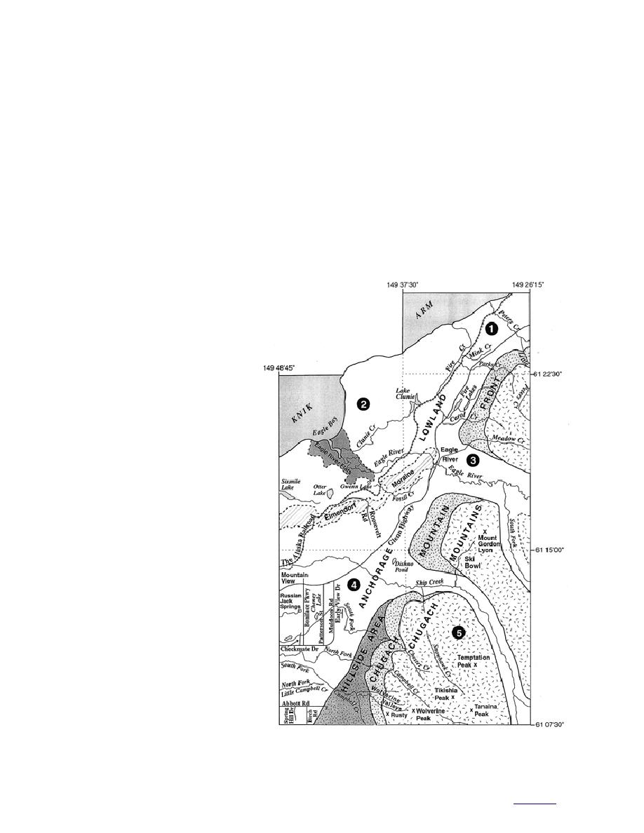
by combining the map unit descriptions of the five
and Dobrovolny (1972a). Other workers who
1:25,000-scale surficial geologic quadrangle maps
reported on surficial geology of the area without
that were used in making the geologic map of Fort
providing detailed maps include Karlstrom
Richardson and vicinity (plate 1) and that have
been published or are in preparation in the U.S.
Geological Survey open-file report series. These
maps are identified by number on Figure A1 and
are listed below along with the quadrangle for
which surficial geology is in preparation.
1. Anchorage B-7 NW
(Yehle and Schmoll 1987b)
2. Anchorage B-8 SE/NE
(Yehle et al. 1990)
3. Anchorage B-7 SW
(Yehle and Schmoll 1989)
4. Anchorage A-8 NE
(Schmoll et al. 1996)
5. Anchorage A-7 NW
(Schmoll et al., in prep.)
The surficial geology of these
quadrangles was mapped initially at
scales of 1:63,360 (northern and east-
ern parts) and 1:24,000 (westcentral
and southwestern parts) by Schmoll
and Dobrovolny mainly between 1965
and 1971 by interpretation of
1:40,0000-scale airphotos taken in 1957
and 1:20,000 scale airphotos taken in
1962. Field investigations were under-
taken by Dobrovolny and Schmoll
(19651971) and continued intermit-
tently by Schmoll (19731983) and by
Schmoll and Yehle (19841995). The
original mapping was changed photo-
graphically to 1:25,000 scale by Yehle
and Schmoll in 19861999 and, except
in the southeastern part, the moun-
tainous parts of the area were
Figure A1. Index map showing location of surficial geologic maps
remapped by Yehle from 1:24,000-
(circled numbers, listed in text) and selected geomorphic features.
scale airphotos taken in 19721974.
41
to contents


 Previous Page
