RESULTS AND DISCUSSION
on toe slopes were fine-grained with abundant rocks,
poorly drained, and had thick organic matter accumu-
Hierarchical organization of ecosystem
lations. Vegetation (Alaska Vegetation Classification)
components
ranged from partially vegetated on steep, exposed ridges
Toposequences
to open low shrub birchwillow scrub on moist upper
slopes to open black spruce dwarf tree scrub on lower
The principal foundation for ecosystem classifica-
slopes. Headwater floodplains supported open and
tion was the survey of ecosystem components (e.g.,
closed tall alder scrub.
topography, geomorphology, soil, hydrology, perma-
Within the Hayes Highland Plateau (Transect 3), the
frost, and vegetation) along seven toposequences.
geomorphology was dominated by old glacial moraines,
Cross-sectional profiles were constructed to illustrate
with minor amounts of headwater floodplain and or-
relationships among ecosystem components of the
ganic deposits (Fig. 7b). Permafrost usually was present.
seven toposequences (Fig. 6 and 7). The toposequences
The steeper, exposed slopes had well-drained, gravelly
are two-dimensional views of the structure of the
soils that supported open tall alder and open low shrub
lithofacies that we used as the basis for classifying and
birchericaceous scrub. Gentle upper and lower slopes
mapping geomorphic units. Examples from various
had saturated soils with thick organic matter accumu-
ecosubdistricts within the four ecodistricts (Hayes
Mountains, Delta Highlands, Delta Lowlands, and
lations and supported tussock tundra and open low shrub
birchericaceous scrub. Small headwater streams had
Middle Tanana Floodplain, see section on Ecodistricts)
fluvial deposits with interbedded silts, sands, and or-
are described below to illustrate some of the main eco-
ganics and the saturated soils supported closed shrub
logical relationships within Fort Greely.
birch scrub and wet sedge tundra.
Within the Molybdenum Ridge Mountains (Transect
5), geomorphology is dominated by weathered bedrock
Within the Little Delta River Glaciated Highlands
(Transect 2), the geomorphology was dominated by
and talus on steep slopes, and colluvium and
glacial moraines, with glaciofluvial deposits near the
retransported deposits on toe slopes (Fig. 7a). We as-
moraine terminus (Fig. 7c). The soils on the moraines
sumed that permafrost generally was present, although
were highly variable, ranging from massive gravel on
rocky soils prevented positive determination. The soils
ridges to fines with trace gravel where eolian silt has
on upper slopes were rocky, excessively drained, and
accumulated, to stratified silt and sandy material in
lacked organic matter accumulations, whereas the soils
Organic, massive
Fines, layered (Fl)
(Om)
Sands, massive
Organic, layered
(Sm)
(Ol)
Fines, massive (Fm)
Gravel, massive
(Gm)
Gravel with fines,
Fines with organics,
massive (Gfm)
massive (Fom)
(matrix-supported
gravel)
Fines with organic
Rubble, massive
inclusions, massive
(Rm)
(Fomt)
Rubble w fines,
Fines with trace
massive (Rfm)
gravel (Fgm)
Rubble (angular
Fines with trace
channels, flag-
gravel, turbated
stones, 2-380 mm),
(Fgmt)
(R)
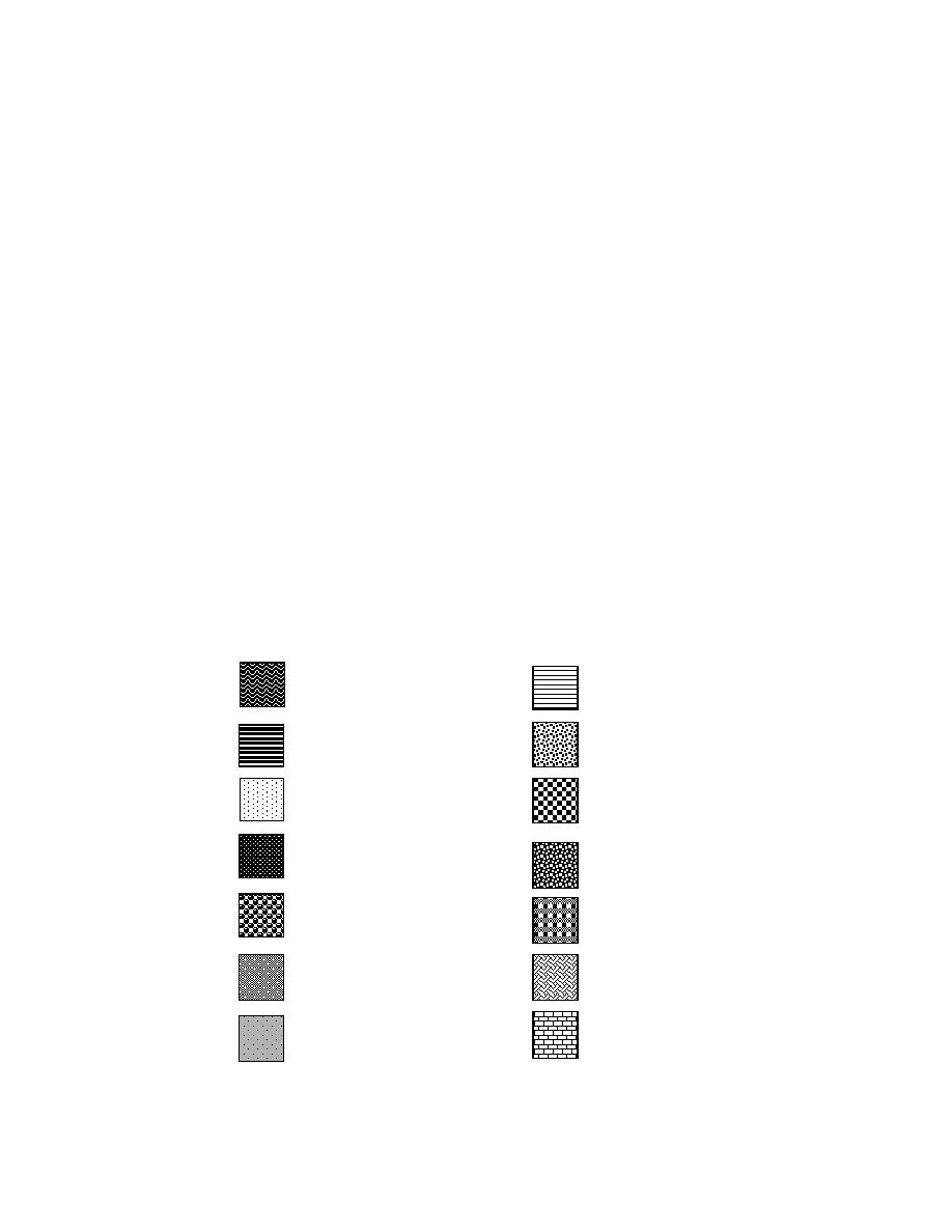
Figure 6. Soil patterns used for lithofacies encountered along
toposequences on Fort Greely.
13


 Previous Page
