1996 photography during spectral classification. We
rangles using ERMapper software; RMS error was 1.0
obtained the large-scale true color photos using a 35-
pixels (28.5 m). For radiometric correction, the image
mm camera and a small fixed-winged aircraft that was
was destriped using a principal components analysis
flown along widely spaced transects across the base.
(PCA) routine from IDRISI software.
These photos were also used for reference during spec-
In spring 1998, initial image classification was done
tral classification. Digital elevation and digital line
using a cluster analysis algorithm (ISOCLASS) in
graph data for 1:63,000 scale quadrangles were obtained
ERMapper to generate 81 spectral classes. The process-
from the USGS.
ing incorporated bands 5 and 7 and two new bands de-
The Landsat TM image was georectified to UTM 6,
rived from these bands. A "vegetation index" was cre-
NAD 27 using 66 control points, which we obtained
ated using the ratio of bands 4/3. The second band was
from prominent features on 1:63,000 USGS quad-
based on the PCA of bands 1, 2, and 3 because these
Scope of Work
objectives
methods
deliverables
Data Acquisition
satellite imagery & aerial photos
existing field and land cover data
other ancillary data
Image Processing &
Data Co-registration
Photo interpretation
Initial Land Cover
physiographic districts
Unsupervised
Classification
other preliminary maps
clustering
Stratification for
Field Sampling
Field Sampling
Intensive
Extensive
Data Analysis
ecosystem relationships
ecosystem classification
Development of
Spectral Classification
Conceptual Model
Ancillary Data
unsupervised
of Ecological
DEM
supervised
Relationships
Photo interpretation
Geomorphic sections
Data automation
Classification Model
sorting of unsupervised classes
Application Development
Documentation
Accuracy
data review
users guide
Assessment
user interface
meta data
QA/QC
Technical Support
Final Products
Technology Transfer
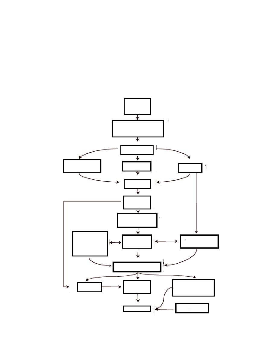
Figure 5. Flow diagram of steps used in image processing and classification
for creation of the ecotype map for Fort Greely.
11


 Previous Page
