10
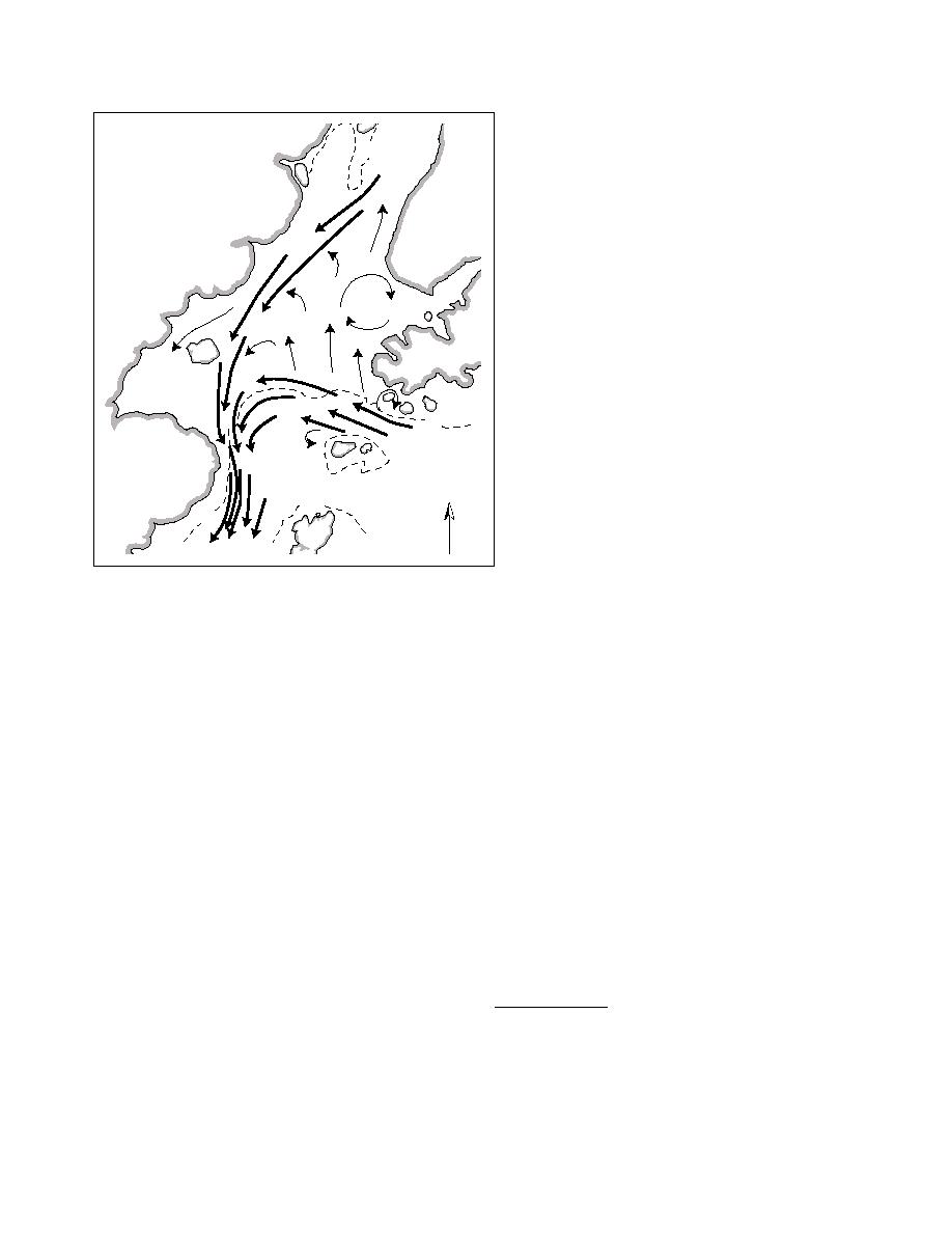
Figure 19. Summer surface circulation pat-
tern in Lower Cook Inlet as proposed by
Muench et al. (1978). Variable currents are
evident near the mouth and in Kamishak
Bay. The 10- and 50-fathom isobaths are
VAR.
indicated by the dashed lines.
VAR.
50
VAR.
50
50
N
perature and salinity. During summer, water on the
chorage are derived from computations using 114 fre-
western side is more distinctly stratified than on the
quency constituents, more than any other tidal station
eastern side, with warmer, fresher Inlet waters over-
in the U.S. (Smith 2000).
lying the colder, saltier oceanic water. North of the
The tidal currents in Upper Cook Inlet are rectilin-
Forelands the water column is uniformly mixed due
ear or reversing. That is, the changing tides are marked
to turbulence caused by the large tidal range and high
by a period of slack water, or no current, before accel-
current velocities over relatively shallow basin depths.
erating in the opposite direction. In the Lower Inlet
While the entire water column mixes vertically with
the tidal currents are classified as rotary in that they
each tidal cycle in the Upper Inlet, this is not the case
never completely go slack between ebb and flood tides.
horizontally. In the Upper Inlet, incoming water still
Instead they diminish at low and high water and change
tends to move northward along the eastern side, while
direction while rotating around to the opposite direc-
fresher, more turbid water flows southward out along
tion (Gatto 1976). In general, maximum tidal currents
the western side.
are 1.01.5 m/s (23 knots) in the Lower Inlet, in-
Southward net flow follows the western shore in the
creasing to over 2 m/s in the Upper Inlet. According
Upper Inlet, around both the east and west sides of Kalgin
to AEIDC (1974), tidal currents range from 0.5 to 3.1
Island and along the western half of the Lower Inlet.
m/s (1 to 6 knots) and average 2.0 m/s (3.8 knots) be-
The net southward flow splits at Augustine Island, with
tween the East and West Forelands, the narrowest point
a branch diverting through Kamishak Bay before rejoin-
of the Inlet. Spring tides* can result in 4.1-m/s (8-
ing the main flow off Cape Douglas. The net southward
knot) tidal currents near constrictions, such as between
flow then exits the Inlet via Shelikof Strait (Rappeport
the Forelands, between Harriet Point and the south
1982). Maintained in suspension by tidal currents, fine
clay- and silt-sized sediment particles are primarily trans-
ported out of the Inlet through Shelikof Strait to the Aleu-
*So named, not because of the time of year in which they oc-
tian Trench beyond Kodiak Island.
cur, but because the tides seem to leap or "spring" higher dur-
The tides dominate gross circulation and turbulent
ing those times of the month when the sun and moon are aligned.
intensity in the Inlet. According to Gatto (1976) the
Conversely, when the moon is perpendicular to the alignment
tidal regimes of the Upper and Lower Inlet are differ-
of the earth and sun, "neap tides," that is, the smallest tides of
ent and both quite complex. Tidal predictions at An-
the month, occur.
56


 Previous Page
