Hydrogeomorphic Floodplain Classification
Hydrogeomorphic floodplain units were mapped for the purposes of indicating flood
frequency for use in delineation. Typically floodplain terraces develop on second-order,
third-order, and greater Strahler stream types (Strahler 1952). First-order streams
typically lacked floodplain terraces because they are located on steeper slopes, have
smaller drainage areas, and are confined to bedrock channels that limit their ability to
create floodplain terraces.
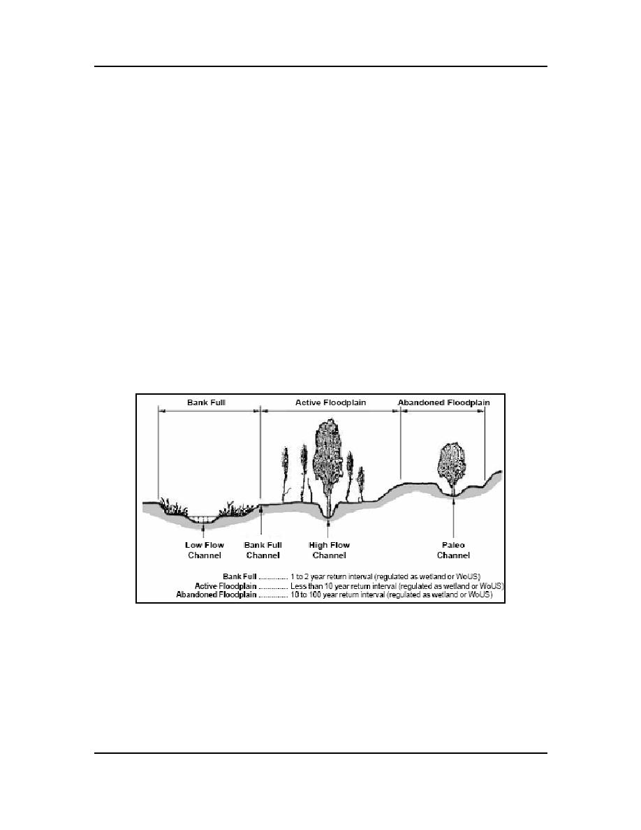
In this study the two floodplain map units identified in the field were the active and
abandoned floodplain terraces (Fig. 3). The active floodplain, in this study, contains the
bankfull and the adjacent active floodplain terrace that contains features associated with
frequent flooding. These features include high-flow channels, unvegetated surfaces, bed
and bank, and a break in slope. The abandoned floodplain terrace is above the active
floodplain and contains features associated with infrequent flooding and seasonally wet
areas. Potentially regulated hydrologic features in this terrace are driven by infrequent
overbank flooding, local precipitation, and occasional groundwater discharge within
paleo channels and other depressional features. Often there is a distinct change of
vegetation community from the active to the abandoned floodplain. The cross section in
Figure 3 represents the ideal floodplain development, but in some instances one or more
terraces may be lacking because of human influence, local soil conditions and
geomorphology, or local precipitation patterns.
Figure 3. Hydrogeomorphic floodplain units.
Delineation Technique
The modification of standard delineation sampling protocols and the development of
wetland probability ratings for Section 404 regulatory purposes for the riparian
vegetation map units allowed for a watershed-scale delineation. The sampling protocols
outlined in the Corps of Engineers Wetlands Delineation Manual (Environmental
Laboratory 1987) and "Waters of the United States" (WoUS) at 33 CFR 328 were
4
ERDC/CRREL TN-04-4


 Previous Page
