Study Area
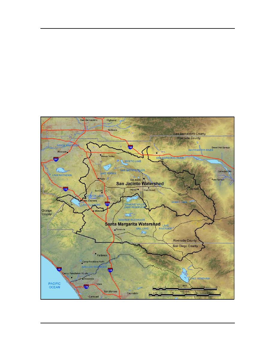
The San Jacinto River and portions of the Santa Margarita River watersheds together
encompass approximately 36,1953 ha (894,405 acres) and are located 12 km (7.5 miles)
southeast of the city of Riverside in Riverside County, California (Fig. 1). The cities of
Temecula and Murrietta are located within the Santa Margarita watershed. The cities
located within the San Jacinto watershed include Moreno Valley, Perris, San Jacinto, and
Hemet. The watersheds are bounded by the Cleveland National Forest on the west and
south and the San Bernardino National Forest to the northeast. The southern boundary of
the study area was limited to the border of Riverside County and did not cross into San
Diego County. However, in some instances, subwatersheds draining from San Diego
County into Riverside County were inventoried and mapped because they influence the
riparian wetlands and flooding within Riverside County.
Figure 1. Location of San Jacinto and Santa Margarita Watersheds.
2
ERDC/CRREL TN-04-4


 Previous Page
