Methods
Mapping Protocols
Potential aquatic resources were initially identified by interpretation of color infra-red
digital orthoquads (DOQ) imagery obtained from the USGS. Aquatic resources were
delineated in the field using the DOQs within a customized geographic information
system (GIS) on a pen tablet computer. All mapping was at a scale of 1:4800, with a
minimum mapping unit size of approximately 405 m2 (0.1 acres). Using the GIS in the
field allowed for viewing of support spatial databases (i.e. roads, contours, parcel
information, etc) to better identify all potential aquatic resources.
The first-order, ephemeral, and intermittent streams were initially identified and
delineated by interpretation of the DOQs remotely. Ephemeral streams were verified for
accuracy and precision using the field GIS as potential aquatic resources were delineated.
Vegetation associated with washes that lacked floodplain terraces were assigned a
hydrogeomorphic floodplain code of "Non-Floodplain Riparian."
Vegetation Classification
Vegetation map units were developed through a series of modifications to the
California natural community classification by Holland (1986). In SAMP efforts in other
watersheds in southern California, CRREL found that existing vegetation classifications
lacked sensitivity for use in watershed-scale wetland delineations. To meet the needs of
identifying wetlands, we developed a classification that followed the hierarchical
schemes of both Holland (1986) and Sawyer and Keeler-Wolf (1995) but added another
level of specificity at the species level. Our classification shares the use of growth forms
and dominant species, with expanded use of additional species identifiers for both native
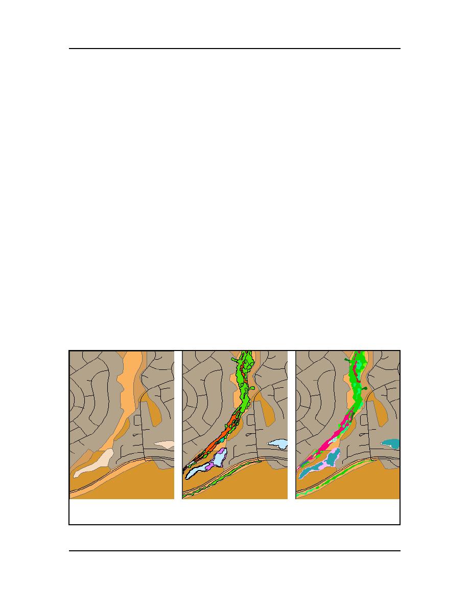
and non-native units. Figure 2 compares the level of detail associated with the Holland
and the USACE growth and species-level classifications.
Holland
Growth Form Units
SpeciesAssociation
Units
USACE Vegetation Units
Figure 2. Comparison of vegetation classifications.
ERDC/CRREL TN-04-4
3


 Previous Page
