N
Tinker
Dam
1 km
2 km
Island
McCray Flats
3 km
Aroostook
River
Gravel Pit
Riverside
Cemetery
7 km
4 km
Bridge
5 km
6 km
Fort
ok
Fairfield,
ro
B
Maine
Pudd
le D
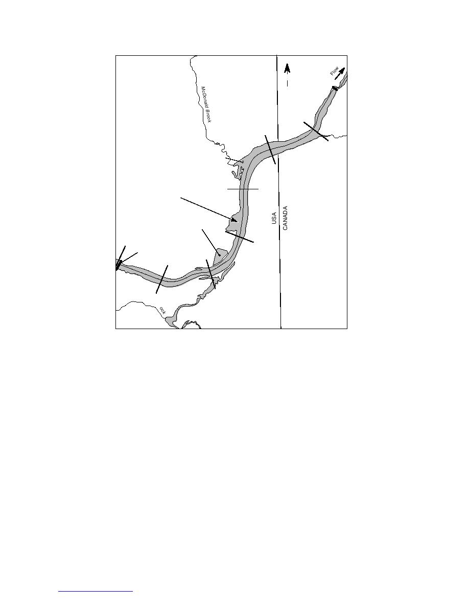
Figure 11. Aroostook River from Tinker Dam upstream to Fort Fairfield,
Maine. (After White and Acone 1995.)
Using the HEC-2 backwater model (U.S. Army
reservoir case. Also, the decreased flow area or the
presence of sediment deposits in the original head
1990), the authors found that lowering the pool
of the pool area may stop the ice run before it
during the ice-formation period would increase
reaches the intact ice cover of the lowered pool.
upstream water velocity and Froude number at
A study by White and Acone (1995) examined
some locations beyond the range of ice cover for-
mation by juxtaposition. The resulting shoved ice
the relationship between dam operation and
cover would be thicker, possibly causing the
upstream ice jamming processes on the Aroostook
River in northern Maine. The ice runs on the
breakup ice run to stop farther upstream than
Aroostook typically stop at the head of the Tinker
under the current operating scheme. During a
Dam pool, a small hydroelectric facility located 6.5
midwinter field visit, thick deposits of frazil were
km below Fort Fairfield (Fig. 11). The town has
measured 2.5 km above the dam, in the same gen-
experienced 18 damaging ice jams from 1927 to
eral area as the observed stoppages of breakup ice
1995. A bascule gate regulates pool level, and the
runs. Using the frazil transport and deposition
daily drawdown cycle is 1.2 to 1.5 m. Within the
theory developed by Shen and Wang (1995), the
typical 425- to 570-m3/s breakup flow range, the
authors predicted that maintaining a steady rather
than a peaking flow during the freezeup period
pool height difference between a fully open and
would result in frazil deposition farther upstream.
fully closed gate is only 10 to 20 cm. Under the
The upstream frazil deposits could cause the
current operating procedure, the gate is up both
breakup ice run to stop at a location closer to Fort
during the ice-formation period and breakup
events.
Fairfield, increasing the ice jam flood threat. The
16
Return to contents pg


 Previous Page
