Upper Mississippi River
Lake
Detroit
Michigan
Lake
MICHIGAN
PENN-
Iowa River
Erie
SYLVANIA
11
N
Chicago
Emsworth
12
IOWA
Allegheny
13
Cleveland
River
Marseilles
15
16
14
Joliet
Montgomery
17 Rock
OHIO
Island
New Cumberland
Dresden Island
Pittsbu
Starved Rock
er
Racine
Pike Island
iv
18
R
Peoria
Hannibal
s
oi
19
in
Ill
Monongahela
La Grange
20
INDIANA
Gallipolis
Willow River
Greenup
Island
Springfield
21
Cincinatti
Belleville
Missouri
ILLINOIS
22
Meldahl
River
WEST
Markland
26
24
VIRGINIA
Alton
Kansas City
25
Huntington
McAlpine
St. Louis
Newburgh
Jefferson City
Kentucky
Louisville
MISSOURI
River
Cannelton
Middle
KENTUCKY
Mississippi
51
53
Green
River
50
River
Cairo
52
Cumberland
River
Nashville
TENNESSEE
ARKANSAS
Tenn
Memphis
esse
e Ri
ver
n
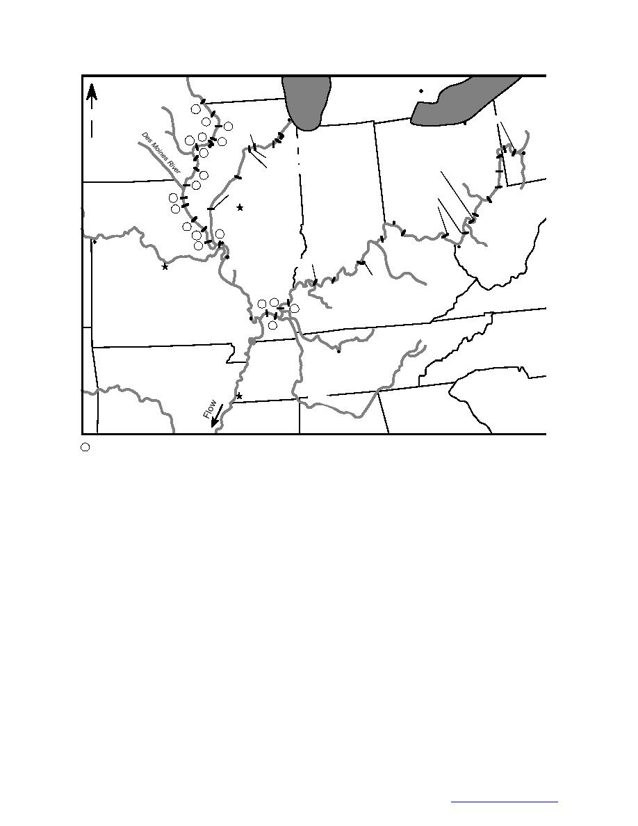
Circled numbers indicate Lock and Dam numbers
Figure 4. Major waterways with winter navigation in the United States.
best ice management strategy is to rapidly form
relatively steady, creating ideal conditions for the
and maintain stable ice covers along the margins
formation of smooth ice covers. Winter navigation
of a smooth-sided navigation channel (Tuthill
may delay ice cover formation by continually
1998). This section examines current flow regula-
re-breaking the ice cover on the navigation chan-
tion and its effect on ice cover formation on the
nel and preserving open water areas where frazil
upper Mississippi and Illinois Rivers, as well as
ice can be produced. The broken ice may jam at
the potential for flow control for ice cover forma-
channel constrictions impeding navigation, or
tion on the Ohio River. The Illinois Waterway is
accumulate and cause problems upstream of locks
the preferred winter navigation route in the Mid-
and dams. These issues are addressed in the Mid-
west because ice conditions are relatively less
winter Period section, as is ice passage at naviga-
severe than on the upper Mississippi. The upper
tion projects during that time.
Mississippi is closed to winter navigation above
On the upper Mississippi and Illinois River
Lock and Dam 20, whereas the entire Illinois
basins, discharge-controlled tributary inflow
Waterway and Ohio River remain open to navi-
accounts for only a small portion of the total main
gation all winter. Figure 4 shows these rivers and
stem discharge during the freezeup period. Table
the locations of major navigation dams.
2 shows average winter flows from the two major
discharge-controlled tributaries of the upper Mis-
Illinois Waterway and
sissippi below Rock Island. These data indicate
Upper Mississippi River
that retaining all reservoir outflow during the ice-
Early winter flows on the Illinois Waterway
formation period would reduce the main stem
and Upper Mississippi River are typically low and
discharge by only about 5%.
7
Go back to contents pg


 Previous Page
