a. Photograph.
b. Binary image of the dusted surface (black portions
are interpreted as leaves).
Figure 7. Dusted surface in Montpelier, Vermont.
which caused flooding in Montpelier, Vermont, the
cross-piece laying on the ice (see Fig. 9). As the ice
most recent of which occurred on 11 March 1992.
thinned, the bottom of the cross-piece indicated
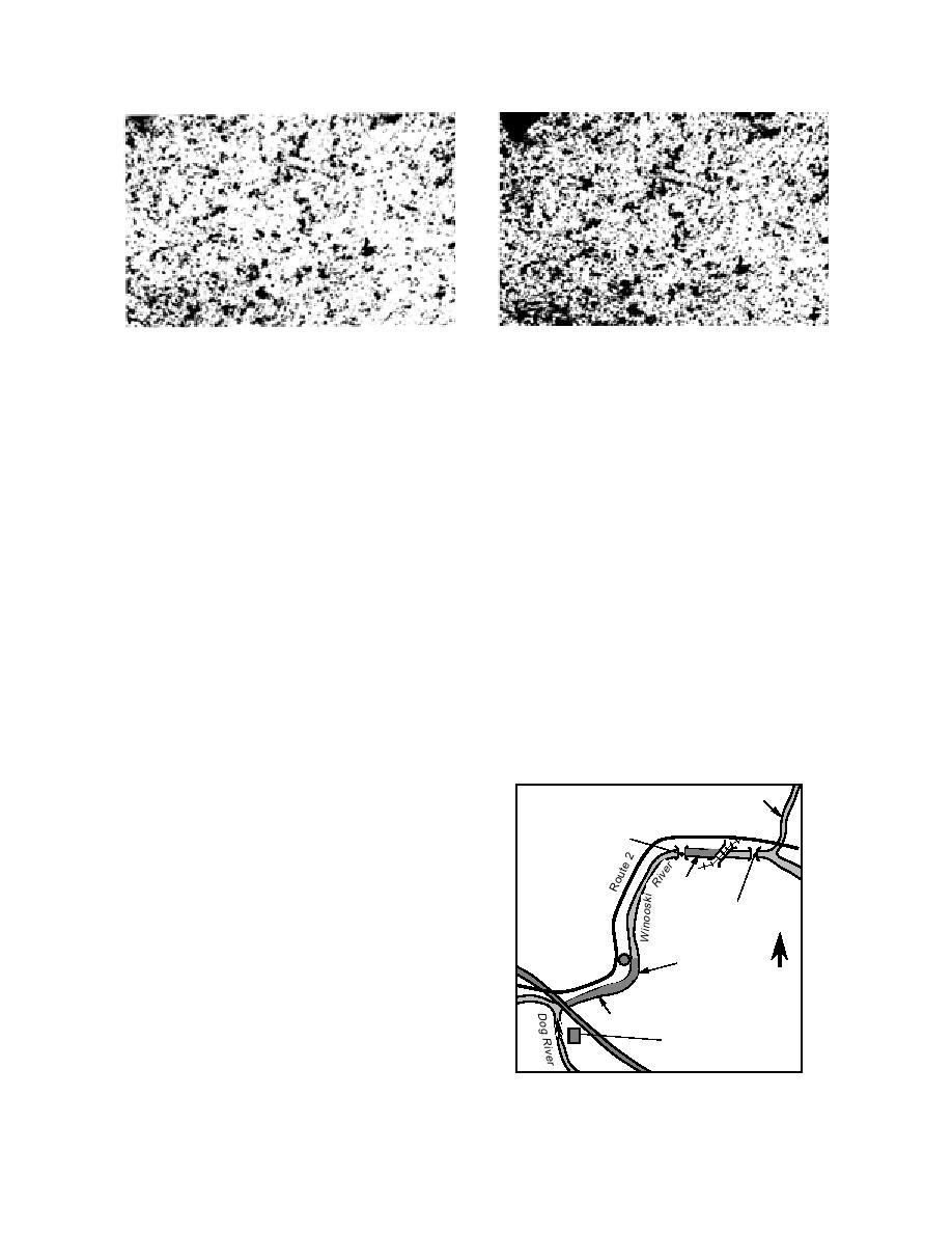
Figure 8 shows a map of the area of concern in
the elevation of the top of the original ice surface.
Montpelier. From the historical record we find that
If snow fell on the leaves the markers indicated
jams frequently formed at or near Cemetery Bend
where the leaves were located under the snow.
(indicated in Fig. 8). The annual formation of a
The leaf mulch was put on the ice by using a
stable ice cover, that extends from the I-89 bridge
200-ft (60-m) length of fire hose with a 3/4-in. (1.9-
to the Bailey Avenue bridge, causes the broken ice
mm) nozzle (the hydroseeder is capable of oper-
from upstream to arrest and jam at this location
ating with up to 400 feet [120 m] of hose). The area
(U.S. Army Corps of Engineers 1994b). It was hy-
covered using the hose is indicated in Figure 10
and was approximately 4,000 m2. It took about 1
pothesized that thinning or weakening the ice
through this reach may allow the broken ice to be
hour to do this. The remainder of the 9,500 L slurry
carried out of the city rather than jamming there.
was spread using the hydroseeder's cannon aimed
We selected two locations along this problem area
upstream from the Bailey Avenue Bridge, and
for testing the hydroseeder and leaf mulch on the
Winooski River. The locations are indicated by the
cross-hatched sections in Figure 8. The area labeled
A was located between the railroad trestle and
North Branch River
Bailey Avenue Bridge. Businesses are located on
Montpelier
both sides of the river at this site; thus it provided
Bailey Ave.
Bridge
a good test of the ability of the hydroseeder to work
in tight confines. The area labeled B extended up-
stream from the I-89 bridge to Cemetery Bend. This
Site A
site had easy access from Route 2, which allowed
Green Mountain
Taylor St.
Cemetery
us to evaluate deployment of the mulch using the
Bridge
hydroseeder's cannon. Both of these sites were
USGS
dusted on 9 March 1994.
Cemetery
Gage
I-
N
Bend
89
Bailey Avenue (Site A)
For the test section at the Bailey Avenue Bridge
Site B
(site A), wood markers were placed on the ice to
Montpelier Sewage
indicate the location to be dusted and the amount
Treatment Plant
of thinning of the ice that occurred in the test sec-
tion. Holes were drilled in the ice and one end of
Figure 8. Location of the test sites on the
the wood cross was put into the hole with the
Winooski River in Montpelier, Vermont.
7


 Previous Page
