gap width of 14 ft. Two smaller blocks bolted to
6.6-ft centers, inclined in the downstream direc-
the sides of each of the main blocks increase sta-
tion. The tops of the piles are roughly level with
bility, bringing the total weight to 40 tons. The
the floodplain elevation. The structures are
upstream faces of the blocks are sloped at 45.
designed to convey a flood discharge with the
The block tops are roughly 1 ft above the eleva-
entire structure clogged with ice or debris.
tion of the right floodplain, which passes the re-
Installed around 1970 to solve ice jam flood
lief flow but is not intended as an ice storage
problems created by reservoir construction, little
area. A major portion of the structure's cost lies
is known about their performance since 1974.
in riprap for bed and bank protection in the vi-
The Hungarian structures are similar to the
cinity of the blocks, and also along the banks
structure on the Credit River. Both use piers,
where the relief flow leaves and re-enters the
spaced at 6.6 ft, to create grounded jams, forcing
main channel. The design process included a
relief flow and ice onto the floodplain.
physical model study in the refrigerated re-
search area in the Ice Engineering Facility at
Weirs with piers
CRREL (Lever 1995). The prototype performed
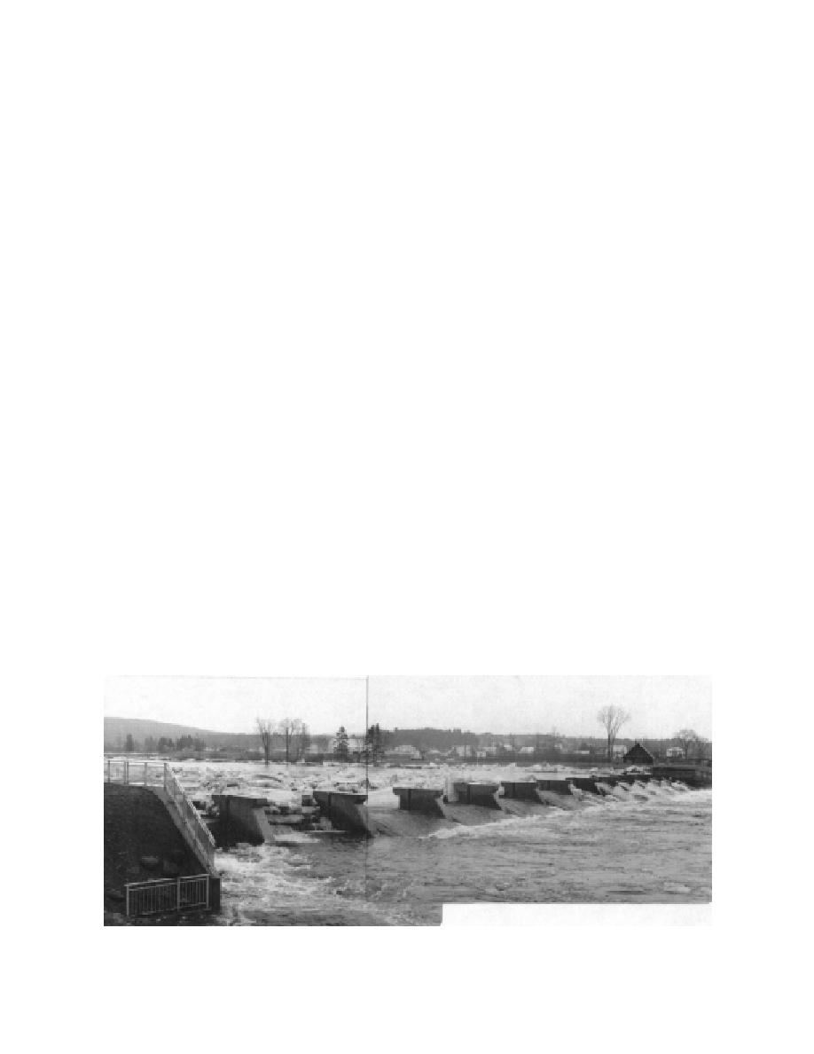
A 15-ft-high by 260-ft-wide concrete weir
well during its first winter (1994-95), retaining
topped with 6-ft-high piers on the Ste. Anne
breakup ice runs in early January and mid-
River protects the town of St. Raymond, Quebec,
March.
from breakup ice jam flooding (Fig. 19) (Deck
Three poured concrete "icebreaker" blocks
1984). The piers are spaced roughly 20 ft apart.
were installed in the Mohawk River, one mile
An earth berm connects the structure's left end
above the village of Colebrook, New Hamp-
to the higher ground to the left of a 500-ft-wide
shire, some 50 years ago. The bed slope at the
floodplain. The structure creates an ice storage
blocks' location is relatively steep, and the
reservoir 700-ft-wide by several thousand feet
blocks do not stop the breakup ice run. After
long, passing the relief flow beneath the ice
consulting with researchers from CRREL, the
accumulation in the main channel and directly
New England Division of the Corps of Engineers
over the weir. The design must ensure a pool
in the early sixties planned to create an ice stor-
level high enough to reduce the approach veloc-
age reservoir to alleviate the ice jam flooding at
ity and water surface slope so that excessive
Colebrook (Assur and Frankenstein 1963). The
thickening does not result in a grounded jam at
proposed timber crib structure, with a centrally
the structure. If the weir failed to pass the break-
located concrete spillway, was never built, how-
up flood flow and the berm on the left were
ever.
overtopped, a small housing development
Two pier structures in Hungary protect the
would be flooded. This consideration indicates a
villages of Jaklovce and Zilnia from ice jam
high level of confidence in the design. Six-tenths
flooding (Brachtl 1974). Both structures consist
of a mile downstream, the town of St. Raymond
of 8-in.-diameter concrete-filled steel piles, on
lies on a flat valley bottom, below a relatively
Figure 19. Weir with piers ice control structure on the Ste. Anne River, St. Raymond, Quebec. (Photo courtesy of
Marc Delagrave, Roch Ite Groupe-conseil, Sainte-Foy, Quebec.)
16


 Previous Page
