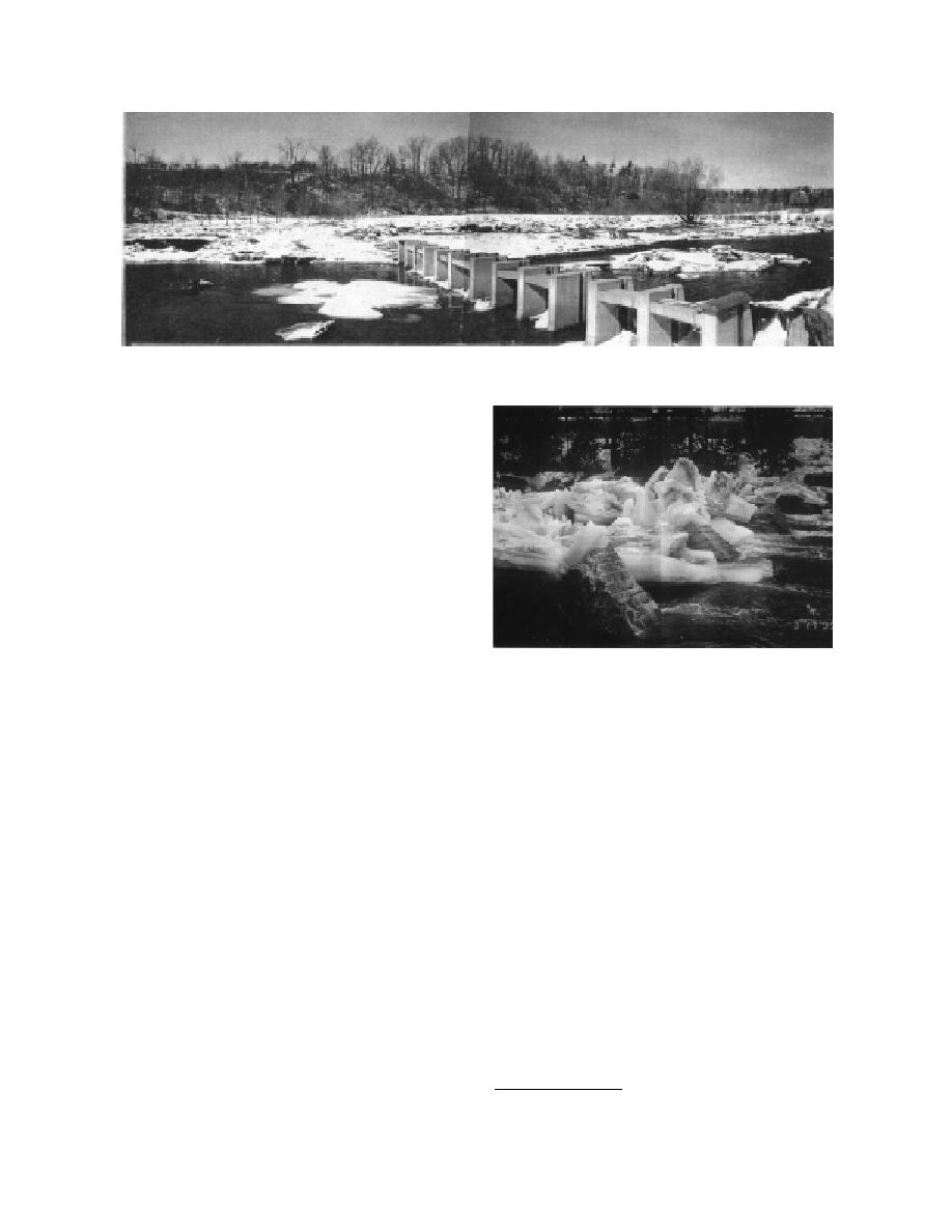
Figure 17. Credit River ice control structure following breakup, March 1994. Note the ice stored on the right flood
plain. (Photos courtesy of Harold Belore.)
a weir, with water flow and ice passing over its
top. The submarine net requires some mainte-
nance, mainly in the form of debris removal.
Perham (1983) reported the use of an experi-
mental breakup boom on the Chaudiere River in
Quebec in the sixties. Available descriptions are
sketchy. Apparently the boom resembled a hori-
zontal rope ladder constructed of two 1-in. cables
and structural steel rungs. The spaces between
the rungs were filled with wooden blocks. At-
tached to heavy concrete shore anchors, the
boom was expected to retain breakup up to a dis-
charge of 7200 cfs (the four-year flood). The
Figure 18. Cut granite block ice control structure in
boom was used in conjunction with a stone weir,
Hardwick, Vermont, following breakup, March 1995.
which was located a short distance downstream.
At Hardwick, Vermont, two booms construct-
ment is designed to store 95,000 cubic yards of
ed of used ski lift cables and truck tires are
ice, two thirds on the right floodplain and the re-
installed on the Lamoille River each winter. In
maining third in the channel. Relief flow passes
order for the tires to stand vertically, the cables
around the structure on the right floodplain,
are relatively taut, even in the no-load condition.
which is spanned by two rows of armor stone,
Due to this no-sag design, cable forces during the
also with 6.6-ft gaps. To encourage relief flow to
ice run are high enough to cause failure. Never-
enter the floodplain, the tops of the armor stone
theless, by temporarily retaining upstream ice,
are 1.5 ft lower than the tops of the piers in the
the tire booms appear to stagger the arrival of ice
main structure. Aside from some scour, occur-
and water surges in the thickly settled reach
ring where relief flow from the floodplain re-
downstream, reducing the chance of a serious ice
enters the main channel, and ongoing debris
jam.
removal, the structure has performed well to
date (CummingCockburn and Associates Ltd.
Piers and boulders
1986b)*.
A pier structure on the Credit River has pro-
A granite-block breakup ice control structure,
tected property downstream in Mississauga,
shown in Figure 18, was constructed in the Lam-
Ontario, since its construction in 1988 (Fig. 17).
oille River, upstream of Hardwick, Vermont, in
The ice control structure consists of 14 concrete
September 1994. The four blocks are located at
piers on 6.6-ft centers. The tops of the piers are
the downstream end of a natural pool, with a
roughly 1.5 ft above the 1.5-year open water
flood level. A grounded jam forms behind the
piers, with the top of the ice rubble 3 ft above the
* Also, personal communication with Harold Belore, May
top of the pier height. The resulting impound-
1994.
15


 Previous Page
