EAGLE RIVER FLATS FY 00
72
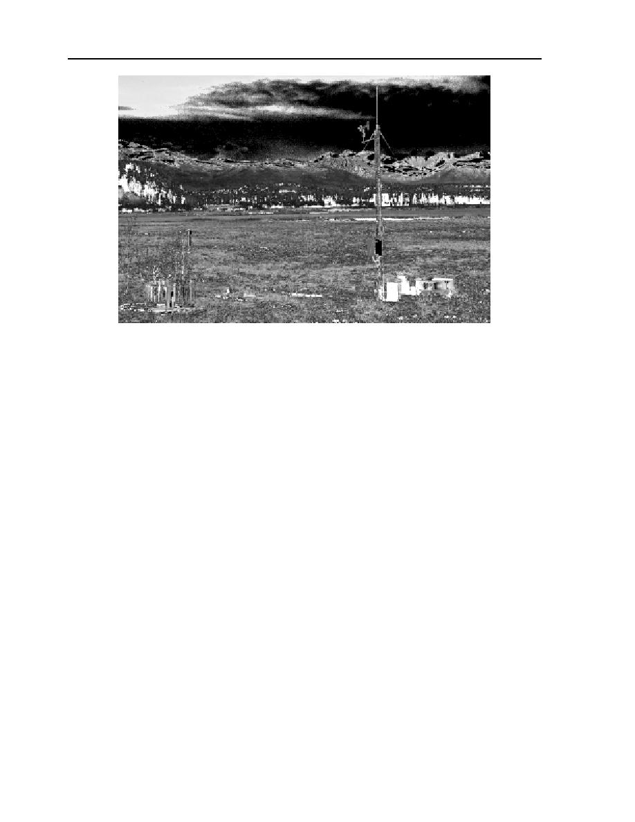
Figure III-4-1. Eagle River Flats meteorological station located off the edge of the
EOD Pad. The 4-m tower is located in the right center, the 1.22-m-diameter evapo-
ration pan is located to the right, and the shielded rain gage is located to the left.
tion and the base station at Route Bravo
METEOROLOGICAL STATION
Bridge. The antenna for the radio is attached
The Eagle River Flats meteorological sta-
t o the top of the 4-m tower. A wind-
tion is located off the edge of the EOD pad on
shielded precipitation gage is located 5 m east
a small gravel pad extending into the salt
of the tower. A standard 1.22-m- (48-in.) di-
marsh of Area C (Fig. III-4-1.) The 4-m guyed
ameter evaporation pan is located 2 m west
tower has a wind anemometer mounted on
of the tower. A Druck pressure transducer
top that records wind direction and speedl; it
mounted on the bottom of the evaporation
is high enough to be above any effects caused
pan measures water depth. A 12-V battery
by the edge of the nearby EOD pad. Air tem-
provides power to the station, and a solar
perature and relative humidity sensors within
panel mounted on the tower keeps the bat-
standard shields are located at 2-m and 0.5-m
tery charged. The instruments of the meteo-
heights on the tower. A side arm at 2 m holds
rological station are summarized in Table
two Epply radiation sensors for measuring
III-4-1.
incoming and reflected short-wave (0.3 to 3
m) radiation. A white fiberglass enclosure
mounted on the tower contains the Campbell
RESULTS
Scientific (Logan, UT) datalogger system con-
sisting of a CR10 Measurement and Control
The meteorological station was restarted
Module and an SM716 Storage Module. All
for the summer season on 12 May 2000. The
meteorological data collected for the season
station was much more reliable than last year.
are stored in the storage module. Also
The elimination of the cell phone link in fa-
mounted in the enclosure is a Motorola P50
vor of a radio link to a base station at Route
radio for communicating between the met sta-
Bravo Bridge and then a telephone line link


 Previous Page
