68
ERDC TR-05-1
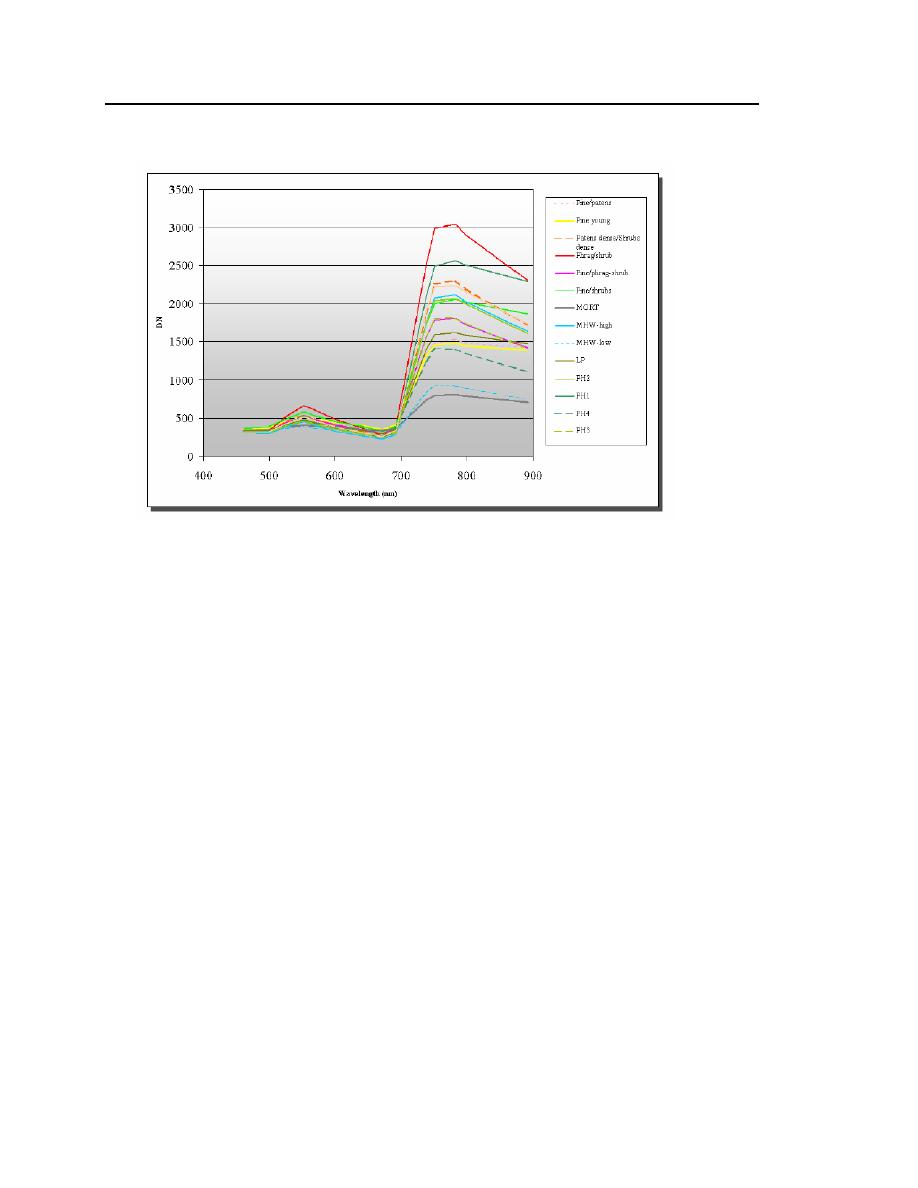
Figure 40. Spectral plots of high reflectance signatures used to classify
the southern mosaic.
5.3.3 Image Classification for Wetland Vegetation Mapping Over Blackwater
Wildlife Refuge
5.3.3.1 Spectral Angle Mapper. The images were classified using the Spectral
Angle Mapper (SAM) routine within ENVI. This function assigns each indi-
vidual pixel to a class based on the calculated angle, measured as the arc dis-
tance, between that pixel's DN values (using all 14 bands) and each of the mean
vectors of the training signatures. The maximum spectral angle is user-defined
within the routine and is given in units of radians, not degrees. For the first run of
the SAM algorithm in the southern mosaic, a spectral angle of 0.08 radians
(~ 4.58) was chosen. The 14-row, 1-column vector for the first pixel in the
image (i.e., the unknown spectrum) and the 14-row, 1-column mean vector for a
single reference spectrum are used as inputs into the following equation.


 Previous Page
